Send any comments to the maintainer Roger Caffin
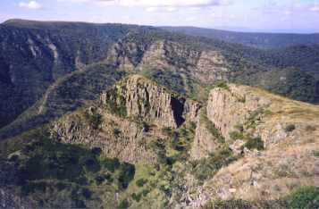
This runs from Walhalla in Victoria to the Tharwa Visitor Centre in Namadgi NP in the ACT, a distance of about 765 km. It should run along the Great Dividing Range, but meanders off in several places. There are a nunber of variants possible in places, so the exact distance is unknown. The end points are the best anchors. Mostly it sticks to well-made tracks, forestry and 4WD roads, but it does venture into real bush in a couple of places. In addition, the Kosciusko National Park (KNP) section is a bit variable because there are no markers through the Wilderness region: you select your own route.
The trip runs through some extremely diverse territory. At the S end in Victoria you seem to spend each day climbing 600 metres up onto a ridge, then you drop down into the next valley. The trees are huge. It wouldn't be so bad except that some of those Victorian fire trails were made by a raving lunatic on a bulldozer who only knew one direction: the steepest. In the more alpine regions you get both the glorious High Country, and some of the lower Alpine scrub. The latter can be a little heavy, but usually has good tracks through it (mostly). It is a trip well worth while doing, but it needs a lot of planning and logistics. That said, the two of us (my wife and I) did it all by ourselves, so you don't need a support team.
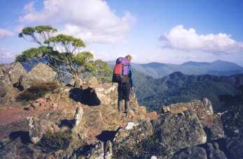
We did the trip in Mar/Apr 1999, in generally mild to reasonable weather. That is, we had a few rainstorms in Victoria (as usual) and two snowfalls in the KNP. Otherwise the weather was pleasant enough, although sub-zero at times. I wouldn't recommend doing it much earlier in the year: the heat and March flies would be a real problem. Winter would be, as Siseman remarks, a challenge.
The two of us took 31.5 days for it, which was fairly fast, but we like travelling fast. The Ranger at Namadgi NP knew of one party who had done it a day or two faster. Of course, for many people there will be more fun in taking a longer time, and that is good. It isn't a race.
We put in all our own food drops while going S from Sydney to Melbourne, walked the route N to Canberra, flew back to Melbourne and then went back N picking up the used drop containers. The drop section took almost two days each way: windy back country roads. All the food in the drops was packaged into two day units so we could take less than the full load: we packed extra in case we were delayed anywhere. The food for each drop was stored in one large rigid plastic (chemical) bucket with a clip-on lid . A green garbage bag lined each bucket, packaging tape sealed the lids, another green garbage bag camoflaged each (white) bucket in the bush. We wrote our names and the pick-up dates on the buckets, but it is unlikely anyone would have ever found them where we hid them. On the other hand, as we found on the Hume and Hovell Trail, every drop showed signs of having been attacked by native animals! We also left kero in 1.25 L soft drink PET bottles at each drop, but we left the kero outside the food bucket, often hiding it under something for more protection. Fortunately, none of the bottles were chewed through.
We had assumed that each drop would have to provide for about six days: we didn't want to carry much more than a generous seven days of food. This decision and the layout of the roads dictated where we had to put in drops: in fact it worked out quite well. It took about 2 hours at each drop site to select what we thought we would need for the next stage and repack. Then came the painful bit of lifting our refilled packs up - oh dear. We also left all the packaging and other rubbish in each drop bucket. There was nothing left behind once we had recovered the buckets after the trip.
The drops were hidden at the following car-accessible sites:
We had packed our normal daily rations, and these were OK for most of the trip. Towards the end we were travelling very fast in cold weather, and we found we were eating more. On the last stage, after Kiandra, we ate about 7 days food in 4 days, but we covered 7 days distance as well. You do start getting more hungry after about 2 weeks. We lost a bit of weight, but not much: mainly fat of course!
We had driven down from Sydney to Khancoban putting in drops, then went on to Melbourne with the rest. We were in a Landcruiser, but any 2WD car in good condition could have gone over the same route. We avoided difficult 4WD roads as they are just too slow and unknown. We stayed in Melbourne with relatives for the night, then took the train to Moe. From there we went to Walhalla by a taxi which we had booked from Melbourne by phone, but it seems that it is a common trip for the Moe taxis. There is also a bus between the two towns - something we did not know about at the time. When we had finished we tried to get a taxi from the Namadgi NP Ranger Station, but it was late in the afternoon and the Ranger very kindly offered to run us into relatives in Canberra as soon as she had shut the Tharwa Visitor Centre up. We pointed out we were "unwashed" and ponged, but she merely laughed. Our thanks to the lady. After another night in Canberra (and a long hot shower!), we flew back to Melbourne to pick up our car for the return exercise.
The "bible" for the AAWT is the book by that name, written by John Siseman. We used the 3rd revised edition, 1998, which had differences from the previous versions. It seems that bits of the track get periodically moved, and you need the latest edition to work out what "they" have done in places. The previous edition stopped at Booromba Rocks, way out in the middle of the bush. This version stopped at the Ranger station or Tharwa Visitor Centre, on the road: smarter. Despite the constant updating of the book, you must be prepared to navigate seriously in places. We found a few errors and quite a few small changes. The sketch maps in the books are all very well, but you would be foolish to go without a full set of 1:100k maps at the very least. Navigating off this scale of map can be tricky, so 1:50k would be better for those regions where you are not on 4WD tracks.
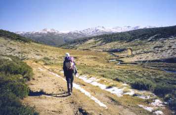
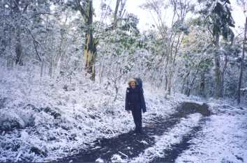
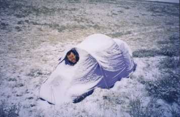
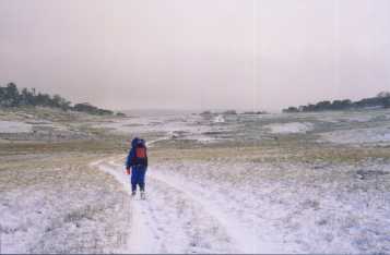
Some of these comments may be out of date if the track maintenance has continued where it was needed. The section from Speculation over the Razor to the Viking, and across the Viking to the Barry Saddle, took care and some planning for water. It was interesting country though, and one of the highlights. A winter trip along here would be 'interesting'. The section from Misery Road down into Limestone Ck required serious navigation: there were some markers all right (hohoho), but this section was new, had no track, and was in thick scrub or forest in places. We had the map and compass in hand for a few hours. Over most of the KNP region there are no markers as it is a Wilderness region (damn good too), and you could have some trouble with navigation in bad weather. We knew this area very well, and went cross country rather than follow the recommended 4WD tracks. It was amusing waking up one very quiet morning to find 50 mm of snow everywhere: that also made the navigation interesting for a day across the Happy Jacks Plain. It can happen any time up there, so be prepared.
There were a few places along the Victorian Alps in the high cattle country where we did have to hunt for water, mainly on the ridges. Some of the springs were either dry, or completely stuffed by the cattle the Victorian Government still lets a priviledged few run up there to preserve their precious votes. Nothing like a nice track in snow grass, completely covered in cow pats. Generally we used a Pur Hiker Filter, and one cartridge would have been quite enough for the whole trip until we tried to filter some cloudy water out of a wombat hole. That did make life difficult. Fortunately, we were able to get drinking water through the filter for a little while longer, and then reverted to Coghlans Iodine tablets. We wouldn't try not treating the water these days, especially in Victoria with all those cattle around.
We used our normal summer alpine bushwalking gear, including a polarfleece jacket and light warm gloves and overgloves "just in case". The "case" happened when it snowed, and then blew. We put on our rain gear for those days as well, and were reasonably warm. Probably the key message here is to be utterly ruthless in leaving behind anything which is not really essential. Pack weight is everything.
At that stage we were still using a Coleman Peak Apex stove running kerosene. We used about 60-70 mL of kero a day between the two of us. We had dropped rather more kero than we needed at each drop: we left the excess behind and recovered it afterwards.
We saw quite a few along the way, but we didn't use any of them. I doubt you could safely rely on them for every night, so a good tent is essential.
© Roger Caffin 1/3/2002