
Send any comments to the maintainer Roger Caffin

In 2002 my wife and I spent six weeks walking along most of the GR10 in France, and in 2004 we spent 8 weeks walking along the GR11 in Spain and doing the rest of the GR10. Organising such a long trip at such a far distance can be intimidating, but it was actually fairly easy to do what was really needed. Finding out what was 'needed' was the difficult part, and is covered here. Basically, apart from a small issue with stove connections, just pack your gear and go.

The letters 'GR' stand for Grande Randonnée in France, or Long Walk. There are lots of them, hence the numbers. In France the FFRP (the national walking club) actually owns the registered name 'GRnn' and the design of the special markers ('balisage') used. They control and maintain these walking tracks, and defend them (in court) against land owners who want to shut them off. Some of the tracks are very old - hundreds of years, old pilgrim routes. Of course, they also sell guide books for these walks, and I can highly recommend the four books for the GR10.
The Spanish have adopted the idea and the name 'GR' as well. They have seen the success of the French tracks, and want to join in. However, they don't have the equivalent of the FFRP and both control and maintenance is a bit more haphazard. Guide books are a private enterprise thing.
Both the GR10 and GR11 run along the Pyrenees from the Atlantic to the Mediterranean. Running along beside the main ridge means of course you go up and down a lot, over every spur coming off the main ridge. Sometimes you actually on the main ridge itself. But this route lets you drop into the valleys where there are towns and villages - and shops selling food. In reality, a lot of the tracks used to be the footpaths between villages, before the era of cars. So in general you can buy food every few days or better. In fact, you can do most of the walks without a tent, by staying in local 'refuges' (more like 2-star country hotels really). As far as we could see, few overnight walkers in Europe actually own a tent: we called them 'refugees'. But there is a hazard: many of these refuges are within a short distance of a road end, and they are often full of pre-booked tourists. When you start running into hordes of day walkers you know you are close to one of the refuges (and a car park). Sigh.
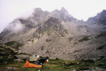
This is on the French side of the Pyrenees, going from Hendaye on the Atlantic to Banyuls-sur-Mer on the Mediterranean. It is on the lee side of the mountains, and is therefore a little cooler and wetter than the Spanish side. Better believe it! In 2002 we had rain or showers most days, but they said it was the worst weather for 50 years. It wasn't that bad: we enjoyed it.
The GR10 has been in existence for many decades, and is quite well organised and well marked. You might think that this could be boring compared with going cross-country, but this is not so. For a start, the over-all length of the track is too much for cross-country, and you would not want to spend that much time going cross-country though that thickly forested country. Anyhow, there are enough opportunities for getting lost or slightly off-track as it is, and you can always make side-trips in the alpine regions. You can also do sections of the 'Haut Randonée Pyrénéene' or HRP if you are really keen.
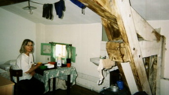
Hendaye is quite nice, and has a number of camping grounds in the town itself. We stayed in one of these each time. The 'old city' has some nice small restaurants as well. As you get in there late and tired in the afternoon off the train, a meal out is not a bad idea. Banyuls-sur-Mer at the other end is a holiday town on the Med. There are a couple of camping grounds there too: the Europeans are big on camping. However, we stayed in the Hotel Canal for a couple of nights: a small relatively inexpensive hotel near the beach. We scored a small garret very cheaply: shades of French artists. My wife Sue loved it.
This is on the Spanish side, and runs from Irun on the Atlantic to Cap de Creus on the Mediterranean. It seems to be a recent development by a group of local councils eager to copy the GR10. It uses whatever local tracks they could find, and as such the route is more variable; some bits are rather rough stony 4WD tracks, while others are rather adventurous high cols on very steep scree. I dare say in 10 or 20 years time they will have cleaned it up a bit. The weather is much hotter and drier - very much so! The heat is not too bad in fact, but the sun can be really severe. The vegetation is a bit lighter in some places, although the Mediterranean end is startling (and harsh). The marking is not too bad, just more variable. Sadly, my camera packed up at the start of the trip, so I didn't get many photos at all.
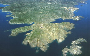
Irun is a large town just across the border from Hendaye, undergoing frantic redevelopment with EU money. We didn't like it at all. We walked to Irun after camping overnight in Hendaye when we were doing the GR11 in 2004. There are two bookshops in the middle of the city, and we found the strip maps in the basement of one of them. Getting out of Irun onto the GR11 was a difficult exercise: the Paul Lucia guide book was not entirely helpful. We figured it out with a street map from the Tourist Information Centre (TIC). At the other end the Cap de Creus is a light house and bar/restaurant: almost no other facilities (and no transport) at all. We camped on a very small site in a bay below the lighthouse (direction ~7:30 from the building) and walked around the coast to Cadaques the next morning. From there we took a bus to Figueras and a train to Banyuls. Banyuls in France seemed a lot more ... civilised.
There are none on the GR10: this is a well developed and enjoyable walking track. You do not need any technical gear.
The GR11 is new, and has some rough spots. The ascent from the Ibon d'Ezcaurri to the peak above is marked up a gully on a rock face. (Ibon = Lake, but it was dry.) From most any angle it looks like a rock climb. My wife and I have both rock-climbed to a high standard, but we declined to do this with full packs. I dare say it does go without too much difficulty, but there is a very nice scenic ridge route a few hundred metres to the west (left) from the small col there. Obviously others agree: the route is cairned. We put this one down to Spanish machismo.
The route over the Collado de Tebarray (or Piedrafita) reaches 2782 m and is either up steep neve or steep loose scree, depending on the time of the year. We had neve, and I managed to kick steps up, stabbing my hands into the fairly dry neve as anchors. It was a bit thin, but we did not rope up. People following us and coming in the other direction used our steps. The dry neve did not make my hands very cold. A short stick each would have been useful. The thing is, I understand the loose scree underneath feels worse! The descent on the other side looks bad, but is short and not that difficult.
The Refugio de Goritz is at the head of the Ordessa Canyon, and the whole area is very scenic. You can even camp next to the Refugio and many do, which is strange as there are many better camping sites a little further on. The next day is a bit rough. There is a shortish high traverse with a lot of exposure, but not technically difficult, or you can go down a valley and up again to the Collado de Anisclo. The guide book says the second route was put in because people found the traverse worrying. Frankly, we found bits of the second route to be a technical scramble in places, and quite tiring. This would not matter too much, except that the 1140 m descent from the Collado into the Circo de Pineta is awful. You go down this zigzag track. Yes, there is a walking track, but it is quite a poor track on very steep loose dirt and loose rock. Our biggest fear was dislodging rocks onto walkers below us. The trouble lies with the winter snows and the very friable soil and rock: nothing lasts, especially tracks. Our knees were a bit tired at the bottom! The high traverse beforehand might have been a better idea.
The route up from Refugio de Baiau to the Portella (pass, col) is up a very steep scree gully. We had had to use our hands in places just for balance - there was nothing solid to hang on to for most of the way. But there is a bit of a track in the scree, and with care it was OK. The col at the top was a lovely spot for morning tea: we did. The descent into Andorra on the other side was really easy in comparison.
The only other 'difficulty' is on the last couple of days: the terrain is unbelievably dry, stony and harsh and the scrub is extremely spiky. Finding comfortable campsites was not easy; finding good water was as difficult. We carried a few litres all the time over this section, and that was OK. But what a contrast!
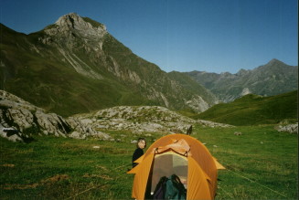
Some of the guide books seem to imply that camping is not permitted. We took no notice, and neither did the other through-walkers we met. It turns out that 'camping' is usually taken to mean 'car-camping', possibly for several days. What we were doing each night was a 'bivouac', and the authorities grudgingly permit this in most places. (They couldn't stop it anyhow.) You aren't meant to even bivouac in the Parc National, but we camped high and ignored that - so did others. Neither are you meant to even bivouac near a refuge - unless you pay a fee. We ignored that too, but we did try to stay out of sight of the refuge. This was a bit difficult sometimes, given our bright orange tent! I think we were approached by only one warden in the whole time, and he was just looking for his money. We weren't that close to the refuge, and there weren't any signs near us, so I pointed that out and declined to pay. Once he found we were not car camping he went away - fairly cheerfully.
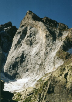
We did camp in proper caravan parks a few times. This happened when we got to a town in a farming area late in the day, did our shopping, and then needed somewhere better than under a farmer's hedge. OK, OK, the hot showers at the camp ground were a bonus... Once or twice the only shop for the village was actually in the camp site.
What we did find interesting was that few of the European through-walkers seemed willing to camp high. They generally scurried down into the valleys every evening. For all the mountains in Europe, it seems that they do relatively little real camping in them. There were some spectacularly beautiful campsites up high too: under the peak in the picture to the left for instance. The 'gear shops' we saw carried day-walk gear but no tents and no sleeping bags. The few tents we saw were pathetic pop-ups, of little use in bad weather. Perhaps that explains the flight to the valleys. We seldom had any company overnight in the mountains.
For the GR10, buy the 4-volume set from the FFRP. They have code numbers 1086, 1090, 1091 and 1092. They contain strip topo maps and are quite sufficient in themselves. Er - provided you can read French. English translations are not yet available. I think Cicerone may have some English language guide books, but they aren't the same. We did also buy some topo maps, but they are very large and were not really needed provided we had the FFRP books.
For the GR11 you can buy a recently issued set of strip maps for the Senda Pyrenaica issued by Edita Prames. I tried buying them over the web, but without success. I ended up buying a set in Irun, the first town in Spain, but finding them was a cliff-hanger. If you can get them beforehand, do so. In principle they are sufficient for the whole trip, and we used them a lot. The set also includes a guide book in Spanish which would be useful if you can read a bit of that language.
Everett Kunitz reported finding this set of strip maps and the guide book on the web at http://www.altair.es, Tel. 34-93-342.71.71, Fax. 34-93-342.71.78, Gran Via, 616 Barcelona E-08007, Spain. It seems to be a large book shop, mainly in Spanish. I had to search on the ISBN to find the maps: ISBN 978-84-8321-187-8 for the 5th Edition, but you can also search on 'senda pirenaica'. He said the postage cost as much as the maps, but in the circumstances I suspect they are worth the cost. You can also get the GR11 buide from the publisher's web site at http://www.prames.com/libreria.asp?PaginaAct=2&materia=45&tipocons=&tamanioPagina=10. The one we had was the 'de mar a mar' one. I think the other two are for subsections of the route.
You can get English guide books by Paul Lucia from Cicerone Press in the UK for both the GR10 and the GR11. I have used the GR11 book but I haven't seen the GR10 one. The books are nicely produced, but even the latest edition of the GR11 book contains many errors and omissions. The author says the GR11 is known as "La Senda" (the track), but no-one anywhere on the ground recognised that name. In particular, take no notice of his instructions on how to get out of the towns: they seemed to be uniformly badly wrong. The Spanish locals are used to being asked where is such-and-such street: often it doesn't exist but they then know (from experience) that you want the GR11. A greengrocer delighted in showing us where the exit went (up a lane next to his shop!). This book has only sketch maps, and is not really enough by itself. However, it does have useful information about water points (necessary in Spain) and shopping, and we used it for that.
There is one more source of information worth using: the local Tourist Information Centres or 'TICs'. They are not everywhere, but they often have little local sketch maps and guides to local sights. Just check the local sketch maps against a topo first: we got caught once coming out of Roncevalles in Spain and found ourselves slightly off-course for a while. But the track did rejoin the GR11 after a while.
It's very simple. We flew to Paris and took a train to Hendaye. We went by QANTAS, but any airline going there will do. There is a train running from the Charles de Gaulle airport into Paris, and the station is under the airport. There are actually two stations (CDG1 and CDG2), but it doesn't matter which one you use. And there is a free loop bus running around the various sections of the airport, but it serves no purpose if you are going in to Paris rather than flying out to somewhere else. The train from the airport is part of the RER network, which appears to be in-between the Paris Metro and the country SNCF trains, but it does link with the Metro. So you can travel entirely by train from the airport to the SNCF station. There are even maps of all this on the SNCF web site , and you can now do train bookings there. The thing about trains in Europe is that there are a lot of them.
Paris is large, and the country trains do not travel right through it. Instead there are a number of stations ringing Paris, and you need to go to the right one for the direction you wish to travel. For Hendaye you will want a station on the SW side of Paris, while the airport is to the NE. But the SNCF site will tell you which one you want. That said, on the second trip (2004) we did manage to find an SNCF train going from the CDG station to Hendaye: don't ask me how it got around Paris: we never found out. We had missed the train we were booked on (the plane was 6 hours late!) and everything was a bit of a panic for a while.
We pre-booked our SNCF train tickets over the internet, which worked fine the first time in 2002 but not in 2004. You normally get in to Paris at about 8 am (baggage collection, customs, etc etc), and several trains leave for Hendaye over the middle of the day. This should allow plenty of time to get from the Charles de Gaulle airport to the country railway station by Metro, and does. The train trip is only about 30 minutes. That is, unless the plane is delayed for 6 hours in Bangkok, as happened to us in 2004. QANTAS could talk to other airlines to rearrange plane tickets, but not to the SNCF. If you get in later in the day there is a night train with sleepers as well.
You could book your train ticket when you get to the station, but the trains do get rather full in summer time (our winter), and the queues at the ticket counters are utterly unreal. And the service there is appallingly slow. You would not believe the shambles. Forget it. I managed to ask for advice at the Information Counter at the CDG station the second time, and they told me I could approach the conductor from the train on the platform when it arrived, and see if he would sell us tickets. It seemed a strange way of doing things, but we did so. The conductor said the train was full, but took our money and waved us on! We had to sit in the baggage section for quite a while, but we were on our way. The only alternative to this lottery is to spend the night in Paris - at some cost. But that's international travel: great theory, but sometimes there are gremlins.
Coming back to Paris was also done by train, but we cheated. We took the night train from Tarascon sur Ariége with a sleeper. The sleepers are quite comfortable, and a lot cheaper than a hotel in Paris. They are quite couth too: they don't stop at any stations after midnight, so you get to sleep. You get in early in the morning, and the plane leaves in the afternoon, so you can have a quick look at Paris as you go. We wandered through the nearby botanic gardens.
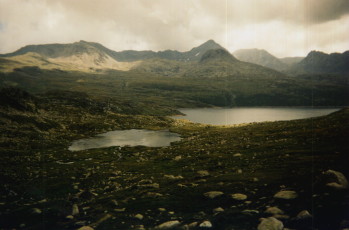
We took our normal Australian walking gear. I took our ultra-lightweight winter tent, but one of my ultra-lightweight summer tents would have been quite enough, especially for the GR11. We took light-weight summer sleeping bags and they were quite enough - starting in mid to late July. For clothing we had our normal Taslan windshirt (long sleeves!) and trousers, a set of thermals, and light (200 grade) fluffies. Rainwear varied, including Peter Storm nylon jackets and trousers and a very light poncho/pack-cover. You will need rainwear in the Pyrenees, especially on the French side. Only 5 minutes after I took this picture we were in a white-out, and later on that evening it hailed.
A poncho is very good at coping with short showers: it goes on over your pack as well. It is interesting that the Europeans do not use parkas they way we do: they all carried ponchos. We have since converted to silnylon ponchos too. I recommend them. Yes, pack covers are also a requirement in principle, although you might get away with a poncho.
Footwear was typically in the jogger or approach shoe class - and one pair lasted the whole trip. Socks were generous: two pairs of good Thorlos or Darn Tough Vermont boot socks each so we could wash one pair every day or two. Broad-brimmed hats were essential.
I took one light ice axe on the GR10 and did not use it. I didn't take it on the GR11. I might well take one if I was going any higher than the GR10 or GR11 though. My wife did carry a stick on one or two of the high cols on the GR11 where there was still some snow, but she found it an inconvenience the rest of the time. I took our little 20 m * 4 mm handline, but never used it.
On each trip we took our Katadyn Hiker filter and used it for all our water. One cartridge was enough each time, and the cartridges were still useful when we got home. The locals and many visitors just drank the water out of the creeks and fountains. It seemed well filtered by the soil. These days I would take my Steripen Adventurer instead, with a solar recharger.
We each took our credit cards (two: one in reserve) and used them at ATMs. You won't find ATMs in the very small towns, but they are in the larger towns and the larger shops would all take our credit cards. Five seconds and the transaction was approved, from our bank in Australia. Really, money has ceased to be the hassle it used to be. You will need some cash for ice creams and cans of Coke: we went through 'a few' of those in the hot Spanish weather.
Forget about expecting to buy what you normally take walking in Australia: you are not in Australia. But there are plenty of alternatives if you are flexible. Some walkers bought all their meals in refuges and bar/restaurants, but I think this worked out fairly expensive. On the other hand, they didn't have to carry much weight. You can also buy very large 'sandwiches' in the bars: half a baguette with meat and cheese. Some walkers had these for lunch. We were tenting, and we cooked our own meals.
We were able to buy some breakfast cereals in France, but the Spanish do not seem to eat them, apart from the vile dreaded 'CocoPops'. We tried these once: never again! - they are absolutely ghastly, and we threw the rest out. I was able to buy muesli in large towns in France or make up versions of muesli by buying oatmeal and some dried fruit and nuts, but in Spain I resorted to muesli bars at the N end of the track and bread and jam at the S end.
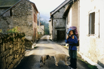
In fact, we ate a lot of bread in both France and Spain. They make real bread there, unlike the Sliced White Wettex you get in Australia. 'Baguettes' are the norm: long loaves of crunchy white bread, but 'pain de campagne' is a wholemeal or part-rye bread which lasts well and is even better. It is worth taking a large plastic bag inside a large nylon bag to store the bread and stop it from drying out. We cut the baguettes in half to get them to fit in our packs, although we did see people with baguettes just tied to the top of their packs, along with their mats. Bread is very cheap and very widely available. In the picture here my wife's pack looks huge, but it was not that heavy: the top section held several baguettes, unsquashed.
Butter and jam are widely available, and there are many, many different cheeses, all interesting. The local brie cheese in France sells for peanuts, and we ate kilos of it. For some reason the local French cheese tastes a lot better than what you can buy in Australia. I think it is becasue it is made locally from unpasteurised milk. But don't worry: the herds are tested regularly. I also got stuck into a bit of the local salami-style sausage, called 'saucisson sec'. It is much less fatty than the Australian 'salami', which is very Italian.
I took some Settlers Beef with me for dinner and spun it out a bit at a time. This worked quite well. But the easiest dinners were pasta and a packet of soup, with cheese or local sausage chopped up and piled on top. There are a couple of (packet) vegetable soups which were really good - much better than the 2-Minute noodles you can buy here in Oz. We tried the local rice, but it seemed to take half an hour of cooking before it was soft enough. There are also small 'madelaine' cakes widely available in Spain, and very cheap. They are good, with sugar, egg and butter in them. We often had them for desert. I won't mention the pastries in France: they were a serious temptation - and we indulged. After all, we were working very hard ...
What does matter is where to buy food. Both the GR10 and the GR11 are designed so you drop into a village ever few days - every day in some sections. Most villages have a small shop selling food. OK, not a huge range, but always enough. But there is a trap here. In both France and Spain the shops all shut for a siesta, typically between 2pm and 4pm. You get there before or after siesta, or you wait. In France the shops may or may not be open on the weekends - it varies widely, and they may even shut one afternoon during the week. It could be a bit of a lottery. In Spain they were conveniently open every day of the week. We often arranged to get to the shops around lunch time. We would then have lunch and pack while the Spanish were having a siesta. It is hot in the afternoon, and we could understand why they knock off then.
Just as important as dry food was fresh food. We could always buy fruit in the little shops, and we did. If there was yoghurt (4-packs) we bought that too. Repacking would be interrupted by eating all this stuff. I would keep two cartons of yoghurt and two bananas for desert that night. Sometimes I could buy a small packet of sliced ham or cooked chicken, and that went into the evening meal too.

The message here is simple: use gas. We saw very few petrol stations, and I don't remember ever seeing anything resembling Shellite or Coleman fuel for sale anywhere. I didn't see kero more than once or twice, and metho was about the same. We did meet several very disconsolate walkers clutching their Whisperlites and whatever: they couldn't get any fuel anywhere. We used gas, and enjoyed many morning teas in salubrious settings.
Gas comes in four forms. Quite a few shops and especially caravan parks had the small caravan LPG gas bottles, but they are far too heavy. The small Bleuet puncture cartridges (100% butane) were fairly widely available, but I don't trust the stoves since one leaked inside my pack near the Cobberas on one trip. They freeze up easily too. The screw-thread or Epigas cartridges may be readily available here in Oz and in the UK, but the French don't use them, and we only saw them a few times. The French Twist-Click CampingGaz cartridge is the thing, and we lived off those in France and Spain - but you need a campingGaz stove to go with them. OK, they are fairly cheap. I bought the taller 450 g cartridges for the greater capacity, and was able to restock often enough. The really little local shops didn't have them, but any moderate size town seemed to be OK. I think the local shops are getting the message because the availability of gas seems to increase each year. For the two of us with morning tea and dinner, one 450 g cartridge lasted a solid two weeks.
These were long trips: six to eight weeks of very fast walking. We keep saying we will take it easy next time, but we never do. Several points did come out of the trips.
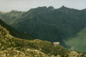
As mentioned above, the 'refuges' in the Pyrenees are generally two and three star hotels. You will reach a 'guarded refuge' up in the mountains only to find it has three stories, can accommodate 90 people and has keg beer on tap (as shown here). They get resupplied by helicopter in many places, or by closed 4WD road. We avoided them: expensive and full of tourists who walk the short distance up the road. (It is interesting that on the GR5 some of the Refuges really were much simpler 'refuges' with a single warden rather than hotels.) Spectacular views for many of them, but we had even better views higher up.
In fact, for the GR10 we only stayed in accomodation in two places. Once was because we were in a long narrow steep-sided limestone gorge in a howling storm, all the creeks were undrinkable brown mud, and there were no campsites anywhere. Fortunately that accomodation one was a converted barn at a farm, and quite nice. The other was on the last night when I snapped a tent pole and bad weather was approaching. Curiously, that Refuge was almost empty that night. Ah well. On the GR11 we tented the whole way. Well, of course, we did stay a few nights in hotels in small towns at the ends of the trips while we cleaned up and waited for the day of our booked plane flights. Well, they had hot showers ... and were a lot cheaper than Paris.
© Roger Caffin 1/3/2002, 2/10/2004, 12/12/2008