
Send any comments to the maintainer Roger Caffin

In 2006 my wife and I spent a couple of weeks in Central Australia and during that time we walked the full length of the Larapinta Trail, from Mt Sonder to Alice Springs. Organising this was easier than organising an overseas trip, but the logistics still took some work.
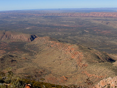
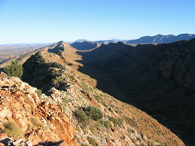
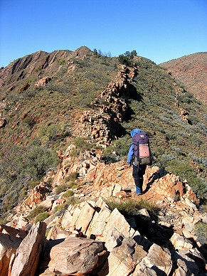
West of Alice Springs the rugged MacDonnell Ranges stretch out for about 230 km to Mt Sonder. They aren't a conventional 'European' mountain range with a single watershed; they are the residuals of some 60 million years of erosion, and have their own very different character. Once there was a huge buckled or uplifted range here, with layer upon layer of different rocks. Most of that has been worn away. So are they gentle eroded mounds? Nothing like that at all! The rock which remains varies between hard and unbelieveably hard, so it sticks out super-aggressively in places. The tilted rock layers which are left have fractured so one side of the range is almost always a scarp - but the tilt is so severe that the other side is usually pretty steep and rocky too. Soil on the ridges? Forget it! Around (below) the rocky ridges you find a sandy flood plain, almost flat in places. The sand is deep: there is little or no surface water out there. This is very different country.
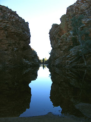
But it is not just one long stretch of ridge. In fact the 'spine' is a series of shorter crests, with 'gaps' and bits of flat flood plain between the sections. Obviously the area was the scene of some quite active geoological movement at one stage, with lots of different folds and tilts. Of course, rivers have come and gone over the millenia too, and have punched those 'gaps' through the tilted strata. Where the cliffs have constricted the flow there are deep waterholes, with a totally different vegetation and lots of life concentrated around them. There is no such thing as a single watershed in this country.
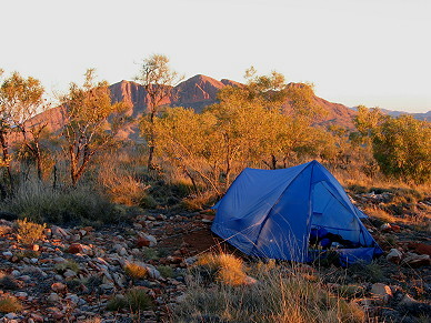
The creation of the Larapinta Trail was started in 1990 as a way of attracting tourists and backpackers, and it was completed in 2002. It traverses the various bits of the West Macdonnell Ranges, linking several crests together. It is marked along the way and there is now a visible trail the whole way, althopugh some sections are less obvious at present. Doubtless as the years go past the newer parts of the trail will become more obvious. The route is nominally divided into 12 sections, according to the NT Parks maps, but that does not mean very much at all. The maps are numbered from Alice Springs outwards, but that does not mean much either. The guide books allow around 15 days. However, many people just do day walks or visit the waterholes (which are worth visiting for sure), while others sign on with a guided tour. The latter are usually based on a 4WD vehicle with huge canvas swags; actual guided walking parties seem to be less common. We met 4WD tours but no real 'walking' tours.
| Night | Camp site etc | Water supply | Comments |
|---|---|---|---|
| 1 | Dropped off at Redbank Gorge | Tank | The air flowing through the gorge was DAMN cold overnight - sub-zero! |
| 2 | Rocky Bar LO | Carried | Very small campsites among the Spinifex and rock! Spectacular morning views of Mt Sonder. |
| 3 | Ormiston River in Ormiston Pound | Waterhole | Going across country to Mt Giles, off track, and camped by waterhole in dry river bed |
| 4 | Heavitree Range S of Mt Giles | Carried | Explored Springs around Mt Giles, then went cross country and up onto Heaviside Range - tricky. |
| 5 | Lomindra Gully | Carried | Camped in exposed saddle half way up: NOT a good site! |
| 6 | Ellery Creek | Waterhole | Picked up food drop, had a wash in the huge waterhole. |
| 7 | Ghost Gum Flat | Carried | Pleasant open lowlands, water brought from Rocky Gully tank |
| 8 | 'Rocky Talus' | Carried | Camped on a small scree bank at head of Spencer Gorge. We found water further down the gorge. |
| 9 | Standley Chasm kiosk, lawns | Tap | Camped by parking area at entry to Gorge. |
| 10 | Near 'Mt Lloyd LO' | Carried | Cleared our own campsite on harsh level ground, brought water from Jay Ck tank. |
| 11 | Wallaby Gap | Tank | Some marked waterholes were dry |
| 12 | Alice Springs | By about the middle of the day |
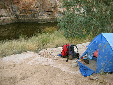
This was an off-track deviation across to Mt Giles from Ormiston Gorge to see what the inside of the Pound and Mt Giles looked like. The Pound is harsh country to walk across without a track, but very interesting. Mt Giles looked rather fierce. We camped along the way, on a sand bank by a waterhole we found in the otherwise dry Ormiston creek bed. The river junction near Mt Giles at 774822 had a medium-sized cairn on it, but this may not last of course.
When we got close up to Mt Giles we were not really where the route we had been told about went up. From the information we had it appeared to be Spur #2 east from Giles Spring. If correct, this looked slightly intimidating from the bottom. We thought Spur #4 looked easier from the base, but did not check either one.
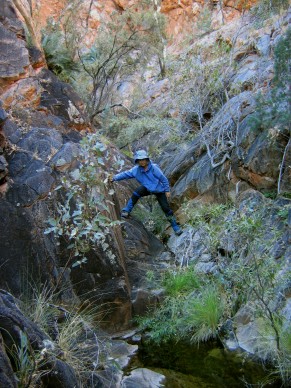
Instead of climbing Mt Giles (we had recently climbed Mt Sonder) we spent some time exploring the many narrow rock gullies cut into the side of Mt Giles: each gully potentially has a spring. We had never seen country like this before. The 'Giles Spring' is at 783831: it's a good pool below a gentle waterfall. The quite narrow slot gully to the E of this at 786829 had a small spring coming out of the rock, with very good water. The way in to it was narrow. The next gully at 789828 also had good water and a fantastic rock water-slide going upwards to a small pool/spring. I got up the water slide (excellent friction and very hard rock) to the small pool, but no further. This was real rock-climbing territory! In short, I believe water should be available most times from at least one of these springs, but don't bother looking for it down below in Ormiston creek.
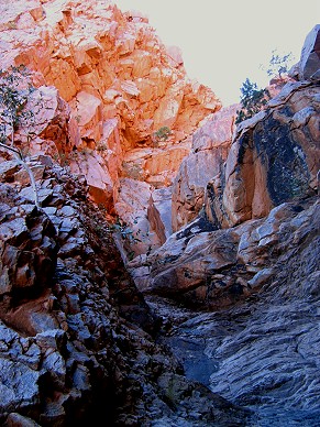
There is good camping on sand about 100 m further up the Ormiston Creek from the junction. There could be some rougher camping around the junction in the side creek at 783827 - but no water there of course. Camping on top of the saddles near the gullies right under the hillside is possible, but you might need to do some work to make a comfortable site. It seems unnecessary to do this however.
After exploring the springs of Mt Giles we decided to rejoin the Trail rather than spend another rday there as we did not know how long it would take us to complete the trip. We could have returned to Ormiston Gorge, but that was the long way around. We went SW cross-country to the Heaviside Range. The route up the side was rather steeper than we expected. Wallabies had done some of the lower part of the route, but we lost their tracks half way up. Anyhow, those wallabies are pretty agile! We had meant to exit the gully we were ascending onto the 'grassy hillside' beside it, but this 'grass' turned out to be steep high-density spinifex country, and just not passable. We were still getting used to the vegetation. We ended up going a rock face and scree slope right to the very top edge of the range. This route was OK for us, but required some rock-climbing skills. It is not recommended. The spur going east from Giles Lookout further to the east might be a better route, as I know someone went up there without rock climbing.
Without hesitation we can say 'in the winter time'. Do not go in the summer! It is far too hot then, and even the locals just concentrate on survival for that period, or so I was told!. Yes, the winter will be cooler, even down to freezing in some places, but that is better than heat exhaustion.
Well, you don't need any 'technical gear'. I did the trip in Dunlop KT-26s, and other have done it in Volleys even. You do need a map and compass: some of the newer sections benefit from a bit of navigation just to make sure.
Camping just anywhere is not possible. The ground up on the ridges can be incredibly rocky, and where it isn't rocky you get either spinifex grass or sclerolina species. Both resemble prison razor wire, but seem to be sharper. Actually, some of the rock is just as sharp too. However, there are campsites here and there where some flat surface has been found and carefully cleared. These campsites are marked on the maps. Some are quite nice too.
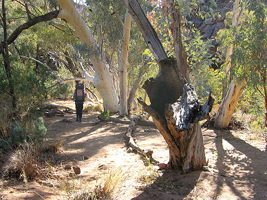
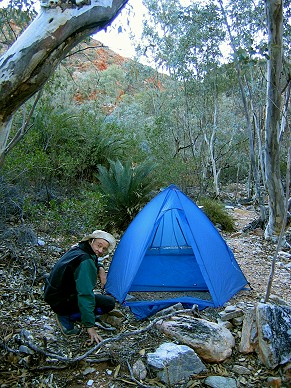
Down on the flood plains it is a different matter. The terrain can be generally just as bad, but there are wide sandy DRY river beds here and there. These make excellent campsites. OK, you would not normally camp in a creek bed on the coast, but this is different. Once you see the creek beds and the surrounding country, you will understand.
You need a ground sheet of course, otherwise the dust will get into everything. We took a tent, but I know some people just take a tarp 'in case' and don't always use it, while many of the 4WD companies only take a tarp for shade at lunchtime. Their clients sleep in canvas swags (or bivy bags).
Given the lack of water in many places and the desire to attract relatively inexperienced walkers to some sections of the Trail, the local Parks rangers have put in tanks at many strategic places, and in our experience they keep these filled up. Every tank we examined had water. We filtered the tank water, probably out of paranoia more than anything else. Not everyone does carry a filter.
There are large waterholes at places like Redbank Gorge, Ormiston Gorge and Ellery Creek, and these are (I think) fairly reliable. There are many smaller waterholes which may or may not have water in them. Some of the ones labeled 'permanent' in John Chapman's book were dry, and the pool which had blocked the Standley Chasm Gorge was dry, so we walked (and scrambled) through it easily. It would be wise to be cautious about water, even in winter time, I think.
The campsite at Ghost Gum Flat on the plains intrigued us: it had some open tent sites and what looked like a large timber picnic table, freshly built and even oiled. We used it as a table that night, although it had no seats. It was only later that we realised that it was probably a tank stand still in construction! There is no water there otherwise you see, but 4WD access was obviously possible (possibly through locked gates though).
There is a fair bit on information available on the web, including the following web sites
NT National Parks
www.nt.gov.au/ipe/pwcnt
Alice Springs town Council
Central Australian Tourism Industry Association
Northern Territory Tourist Commission
Northern Territory Visitor Centre
Welcome to Central Australia
There are good high resolution topo maps on the NT DOC web site. They come as PDF files: 12 of them for the nominal 12 sections of the trail. There are also notes for each section, although the notes don't actually say very much apart from the usual warnings about needing heavy boots, drinking quite incredible amounts of water each day, and wearing hats. You could try the first URL above for the maps.
The PDF maps are good, with vector-based contour lines, but 'they' have plonked big labels and so on all over the details. What a waste. If you have access to a good PDF editor such as Adobe Illustrator you can strip the junk off and expose the contour lines. In some places (eg Mt Giles) this is well worth doing.
There are two Guide Books available, one by John & Lyn Daly and by John Chapman et al. Unfortunately both of these are written for the Alice Springs to Mt Sonder direction, which we found almost impossible to organise (see under Local Transport). The John Daley book seems to be written mainly for international backpackers. The maps have no contour information, which I found unsatisfactory. Others might like it more. The Chapman book hadn't been published by the time we went, but John Chapman kindly sent me copies of all the maps. I found the maps very useful: they had the sort of 'sketch map' information I wanted. Not a lot of contours, but some. We used the Chapman maps and the detailed topo maps from the NT DOC web site.
You have four choices. You can walk. You can drive, either by the highways of overlands in a 4WD. You can fly: the Alice Springs airport handles international jets. Or you can go by train, on the Ghan. We indulged ourselves and went there by the Overland and the Ghan from Sydney. Well, it was interesting, but the Orient Express it is not. We flew home. The main advantage of the train is that if there are two or more of you the cost of taking a car as well is about $100 extra. There are plenty of taxis etc in Alice Springs.
There are a number of tour companies in Alice Springs, all eager to drive you around. We used Alice Wanderers and prebooked a ride from Alice Springs to Mt Sonder at the west end, then walked back. This meant we didn't have to worry about being a day early or late at the end. Organising transport back from Redbank Gorge at the west end can be very difficult, making me wonder why the guide books go the other way. All the transport companies can help you put drops in too.
We took our normal lightweight summer Australian walking gear. Long sleeves and a good hat of course. The first night got down to sub-zero, which was stretching our gear a little, but thereafter it stayed above zero. The daytimes started cool though - which was nice. Thermals and a 200-weight fleece jacket were enough. We took 4 PET bottles and a wine skin as well so we could dry camp - and we did.
We took all our food with us, prepacked. However, if we had wanted we could have bought exactly the same food in the supermarkets at Alice Springs, and the main gear shop there (The Lone Dingo) seemed to stock all the standard freeze-dried food we get in Sydney.
We had one food dump along the way, at Ellery Creek. Alice Wanderers had some locked steel boxes there: very vermin proof! They were happy to have us leave our rubbish in the same box after we picked up the food drop - provided it was bagged up. We left some food behind in the box with a request they they might hold it for us to pick up when we got back to Alice Springs, but they just threw the lot in the rubbish bin. Hum ...
Since we travelled by train we took our gas canisters with us, but we could have bought them all at the Lone Dingo (southern end of Todd Mall)in central Alice Springs. You can't carry fuel of any sort on the plane, so shopping at the Lone Dingo would be the solution there.
There are caravan parks, B&Bs and hotels, in increasing order of expense. We spent a couple of nights in a B&B after the trip, seeing Alice Springs and waiting for our flight home.
I have to add a caution here for those without a car. The locals do not walk around near the center of Alice Springs in the evenings; they drive. There are a lot of unemployed aboriginal youths around who have been known to cause some problems to people walking around solo after dark. We were 'followed' once ourselves.
© Roger Caffin 1/3/2002