main

Archive | Walks

Kimberley Wilderness Expedition

Kimberley Wilderness Expedition by Stephen Millard

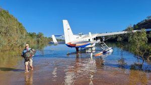
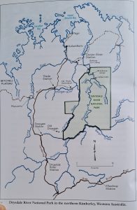
Imagine a National Park that is so remote that it has no signage or roads, but has books published about its trove of unique and ancient rock art: think of Drysdale River National Park in East Kimberly. Last June we were invited by fellow Byron Hikers Club members on a 12 day commercial adventure so inaccessible that we had to fly there in a float plane and land on the Drysdale River.

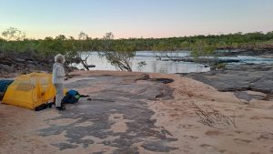
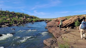
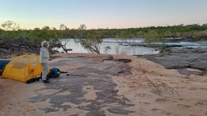
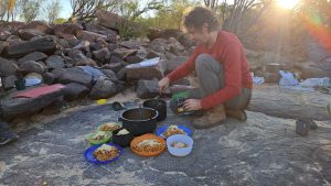
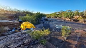
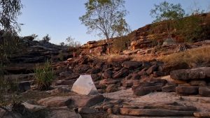
After landing next to a shallow sandy beach and unloading our packs and the food, we set off on an easy 7 kilometre walk through tall grass along the river bank. After several cooling-off swims and lunch, we arrived at our first camp which was on an expanse of smooth rock right beside the river. Our guide, Sebastian, soon had a 3 course dinner prepared for us. It started out with a first-day luxury; perfectly ripe Haas avocados with Seb’s own vinaigrette dressing, rice crackers with re-hydrated hummus and beetroot dips followed by pasta with lots of veggie chunks that Seb had dried himself. All the other evening meals were amazing and featured treats such as creme brolee with rehydrated mango cheeks.


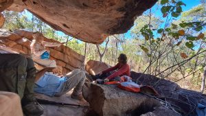
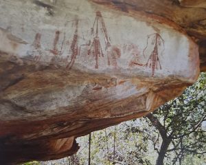
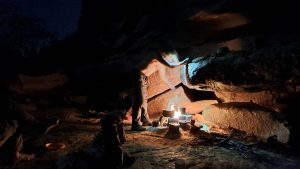
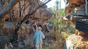
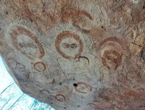
We visited the first of many rock art galleries the next day, not far from our river camp. The paintings included figures that had been termed ‘Bradshaw’ and are now known as Gwion Gwion. They are very fine-lined pictures, often of dancers in elaborate regalia that had been recorded in early photographs of local Aborigines as well as animals like the extinct thylacene and ghostly Wandjina figures. Ochre has been colonised by cyanobacteria to make indelible ‘paint’ that even survives galleries that are flooded during each wet season. The only reliable way of dating these works is analysing wasp nests that may have been built over a painting. The oldest such nest goes back 24,500 years! And that might only be a fraction of their age! As we visited gallery after gallery we kept thinking about what was happening in other parts of the world back then, tens of thousands of years before the advent of agriculture in the Middle East or the pharaohs on the Nile. It is mindboggling.


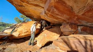
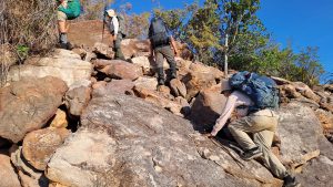
We followed the river downstream for the next few days visiting art sites in shady rock overhangs and camping on stunning river beaches. The river diverted to the east, swung north, then west around three sides of a giant square shape. We walked away from the river through lightly timbered dry savannah in a northerly direction along the fourth, ‘western side’, using one of many fault lines in this plateau of rock to descend a rocky escarpment back to the river. Salt water crocs potentially inhabit this section of the river, even though it is about 100km upstream. Hence we were careful not to swim in the main stream.


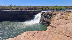
After several more days exploring the terrain and more art whilst moving upriver, we scrambled around the 30 metre high Solea Falls which prevent crocs going upstream. It was relaxing to know that we could swim safely again. After 9 days we were back at our first camp site where we picked up a stash of more food that enabled us to do a final 3 day loop up Planigale Creek. We camped on two different ‘quiet’ cascades, this being a much smaller watercourse than the Drysdale. At the second camp the stream slid about 5 metres over a waterfall into a rock pool as big as several tennis courts. Seb had observed freshwater croc tracks on our way in but we didn’t see any crocs despite much swimming. The next day we had 5 brolgas flying above us as we explored more creekside galleries. They eventually landed just downstream from where we stopped for lunch.

Although every camp on the hike was different, every one was a ‘to die for’ location. On the last day we used another faultline to break out of our ‘continent’ of rock that prevents any vehicle access to this whole area. We were then in an island of savannah that contained a number of small wetlands until we reached the original plane landing site. Here we swam and camped for the last night. The float plane picked us up the next morning as planned. As it droned over the rocky landscape back to Kununurra, I kept thinking about the land below that was so full of rock art and so empty of people. Black fellas moved into a mission to the north a century ago and have never gone back. Only a few of us white fellas have ever visited this magic land. Only a handful of people like our guide have made the effort to explore this remote wonderland.

Initially I couldn’t get my head around the cost of $6000 for this trip because I’m a do-it-yourself hiker who had never paid for a guided trip. Turns out it is quite reasonable considering the first plane airfare is a large part of the cost and that Sebastian is a legend as a guide in the Top End. For me it was a trip of a lifetime and worth every cent. We are recommending it to our Club members for this June.

We used the ‘Mount Connelly’ map on Avenza. Search Gwion Gwion in Wikipedia for rock art references. See here for details of this June’s expedition.

Canberra Bushwalking Club ACT Top Ten Peaks

ACT Top Ten Peaks
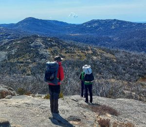
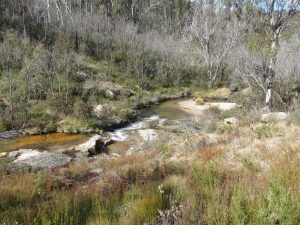
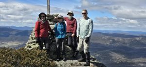
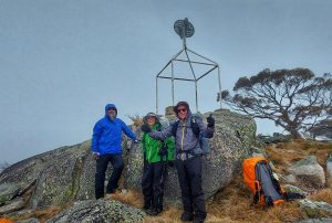
A party of four intrepid CBC walkers, led by Stephen M, have just returned from six days of bushwalking in the remote areas of Namadgi NP. Much of the walk was along the trackless, rugged ranges that make up the ACT/NSW border.
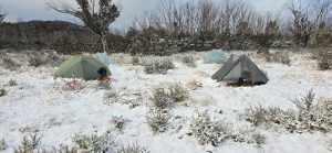
The objective was to visit the 10 highest named peaks in the ACT. Unfortunately, the untimely snow, ice and strong winds conspired to abandon an attempt on two of the peaks (Mts Namadgi and Burbidge). Still, they had an awesome time walking in the spectacular and wild country right on our doorstep.
We are very fortunate for the hard work of those who were instrumental in securing this wilderness area as a National Park.
Happy 40th Birthday Namadgi NP!
Photo credits: Kirk H, Daniel P, Jacqui R, Garry B

The Bush Club – 85th Birthday Celebrations

The Bush Club

Bush Club Birthday Celebration Walks

The Bush Club came into existence on 19th September 1939. The Club was founded by Marie Byles and Paddy Pallin. Both Marie and Paddy believed that the rigorous standards of the tests, pack walking etc., for gaining entry to bush walking clubs was too high. They believed this prevented those who simply want to walk in and appreciate the bush from joining clubs. Their belief was that a love of the bush and a willingness to protect its environment should be the main qualification criteria along with making friendships through bush walking. These core values remain the same for the Bush Club today.

Today the Club has 890 members. While the Club has grown considerably over the years it remains thru to the core values of its founders. The Club places great emphasis on celebrating the creation of the club each year. We mark certain milestones with special events.
The Bush Club celebrated its 75th anniversary in 2014 by completing club walks in 75 national parks all over the world. The walks ranged from the Blue Mountains, the Lake District in England, Horton Plains in Sri Lanka to Los Glaciares in Argentina and were completed between May 2013 and end of August 2014. See here for more information.

The Club celebrated its 80th anniversary in 2019 by completing 80 different club walks by 80 different leaders. The walks were completed between December 2018 and October 2019 from the Ophir Goldfields in NSW Central West to the Garden of Stone and as far afield as the Kerry Way in Ireland. More info.

This year we celebrated the 85th Birthday of the Bush Club. We asked our Leaders to put on 85 ‘trig’ walks / cycles to mark the occasion. As always, our Leaders responded enthusiastically and completed the 85 ‘trig’ events. The trigs were visited between October 2023 and October 2024. These walks and cycles took place throughout NSW, Interstate and the Lake Dunstan trig was claimed on a Club cycle in New Zealand.

All our special birthday events are recorded and a page created on the Bush Club Website for future members to look back on and continue the tradition into the future.

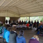
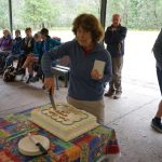
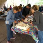
Along with the special occasions, we celebrate the Club’s birthday each year with walks to a central location within a National Park around Sydney. This year the walks finished at Commandment Rock, Lane Cove NP. There was tea, coffee and the birthday cake. We had in excess of 50 members attending the celebrations.

Topographic Maps of NSW 2022 Series

Please note that Bob Sneddon is the sole author of this article.

Topographic Maps of NSW 2022 Series by Bob Snedden

The defining feature of topographic maps are the presentation of the form of the landscape topography via the contour lines. Along with this are the vertical and horizontal grid coordinates for the “Grid References” and “GPS positioning”. The current 2022 Series fail to do this, rendering the maps unfit for purpose and therefore presenting something of a risk to the user. Those who rely on accurate landform information e.g. Rural Fire Service, NSW NPWS and bushwalkers will be directly affected. After examining 20 maps in the 2022 series covering the south coast region, from one outlet all were found to be similarly deficient.

In recent years the need to review the cost of paper map production has led the mapping authority i.e. “Spatial Services” away from the use of traditional lithographic printing. Map production is now outsourced and print production is via the use of laser digital print process. There has also been a departure from pre final run proofing and quality control. The usual casualty of department restructure has been a significant loss of intellectual content. As often happens, a renewal of a departments intellect does not mean and automatic continuity of policy. On the technical side, there is today an assumption that what you see on the computer screen is what will appear on paper. This is Not necessarily the case.

As part of the stream lining of map production, map reprinting is also subject to an “Auto generation” process whereby a reprint is initiated automatically, evidently governed by “barcode” stock records.

The deficiencies with the current 2022 series lies with the preparation of the original computer file provided to the printer. Although the contour lines and grid reference lines appear on the digital version, as seen on the computer screen. This is not what occurs with the laser printed paper copy. The defining map features are there, but virtually indistinguishable.

It is not a new problem for anyone familiar with printing processes. It just reflects the current trend of a departure from traditional approach to quality control. In short there needs to be attention given to the combination of colour selection, printing process and print stock i.e. the actual hard copy paper.

After protracted discussion issues regarding place names I have been advised:

“Spatial Services is still running an old auto generated PDF series which doesn’t include any of the updates you had suggested over the years. Business priorities have led us in different directions and whilst it remains an aspiration to produce, I can’t put a timeframe on when that might happen. Further, the circumstances remain the same in that an auto gen product doesn’t deliver the same level of information and annotation as the old traditionally produced map series”.

Errors in books, are often set aside as “typo’s”. With maps it is more than that. Where topographical information i.e. contours lines cannot be clearly distinguished and place names are incorrect, (an ongoing problem), it becomes a serious matter, critical to public safety. There is an assumption and indeed an expectation maps will be correct. The absence of critical topographic information renders the maps useless for field navigation. In the case of areas of known risk such as the southern part of Morton National Park where it surrounds the former Tianjara Artillery Training Area. The poor presentation of topographical information impacts on the management of use patterns, safety and duty of care, and can include the operation of other stakeholder activities.

Both the printer and “Spatial Services” have been advised of the deficiencies with the current series 2022 maps. Spatial Services where the files originate have stated (as above), they are aware but have no plans to correct the issue in the immediate future. It is unfortunate that “BUSINESS PRIORITIES have overtaken safety concerns and for the Government agency to be producing a product that is unfit for sale is unacceptable. Spatial Services claim they undertake appropriate proofing and quality control measures but this is clearly contradicted if one compares the 2017 and 2022 series.

A recent practice by some, is to download the map and print off the relevant section of interest. Some venture to say you can massage the file, but this requires a degree of skill using special graphic software to enhance to contours etc.

In my own view scrolling around with a computer in the field can be impractical and just grabbing a relevant section of the map does not adequately replace the spread of the full map especially when the overall terrain is unfamiliar.

All these opportunities are possible and will be argued by some. None the less, it remains the current 2022 series of maps are unfit for purpose and should not be on sale, and the “Autogen” process for restocking should be abandoned and the maps withdrawn from sale until there is a decision to correct them.

Stakeholder groups and their members e.g. Bushwalking NSW, conservation group and Rural Fire Service are encouraged to express their concern to the map publisher NSW Department of Customer Service -Spatial Services.

Bob Snedden –
Bawley Point NSW 2539
9th September 2024


Iluka Day Walk – Clarence Valley Bushwalkers

Iluka Day Walk 18 August 2024 – Clarence Valley Bushwalkers Trip Report, by Christine Casey, Secretary

As Christine noted “We are very lucky in this part of the world to have rainforest and beaches right next door to each other, with a river ferry ride thrown in”.

On a perfect winter’s day ten of us met at Yamba jetty for a ferry trip across to Iluka, where we met up with another two of our bushwalkers, to walk around the foreshore to the World Heritage listed littoral rainforest at Iluka.

Although we have done this trip a number of times before, each time it is different. This time we did not have an East Coast Low sitting off the coast, blowing so hard that the National Park was closed, and generating massive swells and waves that threatened to sweep us off the breakwater.

Nor was there a power outage that closed the coffee machines in Iluka. And the track through the rainforest wasn’t so flooded that we had to either bush bash through the smilax creeper or wade waist deep the dark tannin stained creek that used to be the track.

This time we just had a cool westerly wind at the Yamba that had us pulling on jackets and fleeces, then finding shelter downstairs in the ferry for the crossing. Morning tea was in Iluka’s riverside park, out of the wind and in the sun.

The walk itself was relaxed and enjoyable. Conditions were very dry through the rainforest, but cool and shady under the tall canopies covered in vines and epiphytes. National Parks had gone to a lot of effort to replace the old faded signage along the track and at Iluka Bluff picnic shelter. There were now impressive new versions with interesting information about the birds, plants and landforms along the track.

We had lunch at the beach and picnic area at Iluka Bluff then returned in time to catch the 2:30 ferry back to Yamba. Another very pleasant day with friends enjoying our spectacular part of the world.

Byron Hikers – Extreme adventure in the remote East Kimberley Western Australia!

Byron Hikers – Extreme adventure in the remote Kimberley!

Four members of Byron Hikers Club recently undertook an amazing adventure – a 14-Day exploration of the Drysdale River in the Solea Falls area. Drysdale River National Park in the northern tip of the remote East Kimberley is one of the least accessible national parks in Australia. There are no public roads, no airstrips and no tracks – the park is pack raft or seaplane access only.

The Drysdale River flows through a magnificent pristine and untouched landscape. The Drysdale River NP is the kingdom of nature and showcases vast tracts of Kimberley wilderness featuring open woodland, gorges, cliffs, waterfalls and the creeks of the Drysdale River. The many water holes allowed for lots of swimming and every night our camp was a ‘dream’ site.

However, the real treasure of this magical place are the hundreds of hypnotic Gwion Gwion figures, an ancient Aboriginal painting style describing a forgotten time of dancing and ceremonies. Byron Hikers visited different rock shelters every day. See the Byron Hikers Facebook page for more information.

Kelgoola to Widden Valley Walk Via Mt Corigudgy the Hunter Main Trail and Blackwater Creek, Easter 2023

On Friday ‘Good’ there we stood with the Coricudgy in far sight.
With final tweaks to the packs on our backs – a slight heave left & right.
We bid farewell with a nod and a wink, we’ve got this – you’ll see.
We’re off then – our lungs ‘chock-a-block’ – a rhythmic stride us three.
The grade got steeper, our gait shortened up – we’ve now hit reality.
Saplings appeared, undergrowth thickened and fallen trees hindered the ways.
Firm in our mind the known fact – stored water must last two days.
Then out of the bracken a sign post appeared – Coricudgy or Hunter Main Trail
Swift choice, Hunter Main Trail – we’ll walk the planned distance without fail.
But fail we did with the weight of the carry and our bodies seemly weary.
Shoulder to shoulder saplings now rise from a trail – once compacted and dreary.
The wreckage of fires, storms and land slips resulted in trail passage – a farce.
To think one could walk without blundering step – was knowledge that’s simply sparse.
Short of our target with a great threat of rain ‘n’ the wind with a blistering throe.
Rain it did with the push of time, we were sure our tents would go.
The camp was established at an opportune site, sheltered by a Rocky Bluff.
‘Save for’ an anchor to peg rock or tree – proved our tethering was made of good stuff.
With laboured yawn, quick rub of eyes – our bodies still seemingly aching.
The crisp breath of dawn accompanied our yawn to start our bodies a shaking.
The shrill from the dawn bird gave call to rise and welcome a brand new day.
We crawl from tents onto wet sodden ground, muttering ‘four letter words’ on the way.
Oh Saturday’s rise to bitter blue skies and rain mist that’s already proved dreary.
We stretched and nodded with circular gaze and cursed like Farther O’Leary.
We scoffed some breakfast we stuffed soggy packs, at last we’re ready to ‘roll’.
But delay to the start further stifled our heart and surely did sodden our soul.
Intent on regaining lost time, we now fixed on a better day’s sum.
But there at the ready were trail statuettes – of Myrtle and Wattle and Gum.
T’was fresh water we seek from Coachwood Gully, a spring, 12k’s down the track.
The pace was slowed the further we go‘d – thru vine ‘n’ thistle ‘n’ fern we’d hack.
Now the spilling of ‘springs’ gave joy to our ears as we approached the Coachwood seep.
The joy was short lived – as the water ‘let fall’ was from a level – too distant – too steep.
We scooped trickling water from the trail’s sullied surface – yet not a welcoming blend.
We topped reserves, quenched our thirst – allowing our worries to mend.

With dimming skies/stumbling feet – realising the target – we’d fail.
Oh’ for a camp site that’s rock free & level – we’d raise our arms and hail.
There we stood, peering ahead as much as the landscape allowed.
But no such site availed itself, aside from the Hunter Main Trail, whose timbered
growth would stand steadfast and form a protective shroud.
By torchlight that night we circled the ‘wagons’ and discussed our ambitious campaign.
The first to wake would summon the ‘rally’ – without further voice of disdain.
While agreement was made to break camp early – before the hint of ‘first light’.
The Moon’s outstretched fingers, had traced on the ground – Easter Sunday’s delight.
In respect of belief we paused to give thanks then shared our eggs around.
But we refrained from tradition to hide the eggs, simply placing them on a mound.
Breaking camp, quick check of the map to ensure matching numbers we yearn.
Off we strode thru the eerie blue light – towards the ‘point of no return’.
With reserved excitement, quick glance around, we gave the Garmin a check.
A tentative voice was heard to say, not far, just up ahead, I think we’ve got it by heck.
The point to exit the Hunter Main Trail into a gully – so timbered – oh so steep.
A route devoid of direction – down to the banks of Blackwater Creek.
Marking our exit with a ribbon or two we also recorded, grid reference.
Over the ledge us – one two three, to centre the gully was preference.
We gazed around and then looked down to see what we had encountered.
Confirming the grade that we would battle was not one, for the fainthearted.
Many trees had fallen due to rot and decay, thus exposing Tuff’s Rock and grass.
But the rocks were loose and the grass was slippery – we promptly fell onto our brass.
To slow down descent we used our packs to drag tracks and act as a temporary brake.
At each opportune moment we’d slowly rise (some tears in our eyes) – to pluck the burrs
from our arse.
With a grade 1 in 6 and narrowing rock shelves the pace slowed to just a dawdle.
The descriptive expression of some sections to pass – shall remain for all time inaudible.
There lying in wait was a silent bait, covering ground and rock and tree.
Discreet by nature, grey green lichen was defying the eyes to see.
Just add moisture nature declared – to find how slippery it be.
Down we went like bags of spuds to injure, a shoulder, a cheek, a knee.
Counting our blessings we assembled again and continued to the rocky ledge,
A quick ‘memory refresh’ of an abseil book, a plan was hatched, with a ‘sign of the cross’
and a pledge.

Ropes were produced to conquer the ledge, first lowering each backpack down.
Two sets of eyes then gazed on me; I stuttered and agreed with a frown.
We will let you go first, the lightest you be, best to test our knot.
I swung like a pendulum in a grandfather’s clock, when all the slack was got.
The ropes a ‘bit short’ was my retort, realising my feet hadn’t reached the ground.
A quick adjust that saved the day and a bit of a thud when my feet were finally found.
The lasting sweep towards Blackwater Creek was slow but worthy of ‘thy’.
Giant sandstone boulders, long narrow crevasse and a rock face seeking the sky.
With gully bed seemingly narrow, while bordered with sickening vine.
Backpacks required removal, with body and shoulders aligned.
Water increased around our feet that flowed with gathering tempo.
The gully meandered around every bend and dropped into every hollow.
We pushed and shoved dead branches, we skidded on rolling rocks.
The gully bed slowly widened, in short – we had smiles like Goldilocks.
Then was heard the rigorous churning of water flowing afore us.
The mountains sent streams into Blackwater Creek; in parts – nearing ‘full flush’.
Wounded bodies with tempered minds, we finally broke vision upon her, where
time stood still, as we endorsed our will – for the past 3 k’s were tough.
The joy of our meeting enormous, emotions running high, us three blokes in the rough.
She looked so sleek in her movement, her swish ‘n’ sway, with very impressive sass.
While her stream was wide, her banks either side were narrow and tricky to pass.
Again time was against us, we simply failed to complete – the best of a good days walk.
We elected to camp ‘on a snug little spot’ as there was nothing, elsewhere we’d gawked.
Around camp that night we discussed our plight with concerns of what lay before us.
Day 3’s poor achievement, 4k’s out of 9, gave cause for a curse and a cuss.
We rested that night the best we could, with a sloping site and our bodies worse for wear.
At dawn’s first light we peered down the stream and lamented the scene awaiting us there.
Oh blackwater creek you’re coursing’s unique, befitting the terrain that surrounds yee.
The carving you trace over each rapid’s race makes us proud to have finally found thee.
Fallen trees of ancient descent, once so grand ‘n’ noble, are now strewn across your way.
Large battered boulders embedding the sand like warriors defying the fray.
Your carry of water was swift and deep with bottomless pools in the hiding.
To conquer your route, one could not walk your bed, as the sand defied solid striding.
Your banks were steep with toes in the creek and access either side, concealing.
Straddling of boulders, clinging to branches proved clear-cut approach unappealing.

Blackwater Creek ‘oh’ Black water creek what is it from us that you seek.
We pursue you with kindness, we treat you with care, we wonder at your mystique.
Oh you treat us so cruelly, we think you unfair and sometimes you don’t really care.
Is this your true nature or healing you seek from treatment of our forebears.
Why is your water so black so bleak are you bleeding from what lies beneath.
Your name is befitting of the stealth you display, with the obstacles you bequeath.
You flow at will, with regular spill around hazards that are well connected.
You flow thru the groin of thighs, so high, so steep; your secrets are well protected.
Over three days we criss-crossed your flows with varying degrees of success.
On one occasion my legs disappeared into a seemingly sandy abyss.
I eagerly called for assistance, exclaiming I think I’ve got troubles – and
If you don’t pull me out any time soon I think you’ll be looking for bubbles.
Time after time we climbed your slopes to conquer the obstacles bestowed us.
The slopes themselves were a footprint to hell with a view that certainly feared thus.
With thickets of vine grass as high as our thigh and dense scrub obstructing our eye.
Walking was clumsy and hindered by holes and rocks and stumps and logs that lie.
Progress around and along your slopes was agonising and deliberate
Each step performed like a Kremlin guard, lift, stretch, place, transfer the weight
Lift, stretch, place, transfer the weight to stamp ‘n’ pack – swards of vine and grass.
Sweat drips, shirt rips, spill of blood running in silence – an unbearable way to pass.
Lawyer Vine – Oh Lawyer Vine I never knew you existed.
You lay in wait for each weary step with a plan that is utterly twisted.
You run at length upon the ground, hidden in bracken and grass.
You flourish on shrubs with low hanging branches thus blocking our chances to pass.
You invade the canopy of your surrounds and cling with fishhook fingers.
You have no place in this garden of lace – better suited where the Devil lingers.
You’d grab our ankles you’d grab our arms you’d noose our neck our packs.
You let us stride till the tension applied – then you jerked our bodies back.
Step by step we’d fight you off with an angst we failed to surmount.
Over & over we’d tumble & fall into a drunken sprawl – t’was too many times to account.
Ah – quick thoughts of ‘tracks’ with mown grass, all edged with a border of fern.
The weight on our hearts could not be defined on approach round every turn.
The burden on body – the burden on mind – a torment from nature herself.
For the realisation of any such ‘track’ – was ephemeral fiction with stealth.

Over the next three days we battled the maze, with our supplies now running low.
3k’s a day was the best we could make – on the map, really nothing to show.
Our last camp was kind‘a solemn, with pain of injuries that may long-term affect us.
We opened our tents, dragged our bodies thru, and managed to gain Homo Erectus.
Microwaves up and microwaves down – the heavens abuzz with concern.
The message of reply to our welfare – gave no confidence of an upturn.
The garmin seekers, still wearing sneakers, squirmed with disbelief.
Authorities of high degree were let know and offered standby relief.
On the seventh day we were advised we’d be met by a welcoming party.
Quick thoughts of the words, we’ve got your back, felt warm and kind of hearty.
The welcoming team arrived, to our surprise having drinks and food and face washers.
We shook hands and hugged the bad things we shrugged and continued in boots, with the
sound of wet galoshes.
In our quest for success there was never a ‘wrong’ decision made, but one must say, some
were more character building than others.
For must I declare, the days of steep climb, the days of wet clothes, the days of lawyer vine,
were likened to – ’10 rounds’- with Jimmy Carruthers.
In agreeing to walk Blackwater Creek I couldn’t tell if I’ve opened the door to heaven or hell.
If there’s a God in heaven then I’m fairly sure he’s got it in for me, right now I think I can tell
Memories – Oh Memories of events that were bestowed us
I remember the washed out drains that prevented car access at start
I remember first sight with some delight when we first encountered Hunter main
I remember the regrowth that nature provided to recover from the human zoo
I remember first night at the camping site, the blistering wind and the rain
I remember the end of each walking day to feel defeat in one’s toiling heart
I remember the leadership when moods were low, ‘triangular method’ as we all had a go
I remember the moments on Easter Sunday as we gave thanks in a personal way
I remember the scents and the sounds that enlivened true enjoyment in me
I remember descent into Blackwater Creek the experience beggars’ belief
I remember the slips, trips and falls and consoling laughter that fell upon deaf ears
I remember the ‘labels’ we each had carried, like “three points” “wombat” and “stirrer”
I remember the eerie calls at night, not knowing on foot or by flight – and
I remember at night the perils encountered – just for the need to pee,
I remember each morning the shock on my feet, when sliding into – sandy wet socks
I remember the sheer frustration on faces of those with lingering pain
I remember no ill word was ever spoken, just a need to grin and refrain – and
I remember the flak, that I got back, on saying – “just follow the water/ just follow the water”,
whenever the garmin was showed

They say good friends are made in times when the going gets tough
They say good friends are made of, generally bloody good stuff
They say good friends can see through the limits and faults of others
I ask you then, who you think will remain good friends if ‘dark fortune’ should shine upon us
In the safeguarding of pride, real names I would hide, as the intent was not to claim fame.
But for the sake of this story, if you must apply glory, then refer to Eric & Wayne & Graham
While feeling pretty chuffed and proud that we had walked, from where we once started,
came a whispering voice from the cool of the creek, “I warned you it was not for the faint
hearted”.
We thank those who assisted, we thank those who collected and we thank those waiting at
home.
With apprehension, a little tension, we thank Mother Nature herself, in a kind’a guarded tone.
When describing to others the thrill of the walk they listened with a sense of boon.
Then befalls the age old question, – now that you’ve done it, would you do it again.
Well….with a lingering breath and a laboured sigh, I proclaim with this reply!

Hell Yes…..that was only the RECCY!!

Crown Roads Access

Crown Road Management Policy Review
Queanbeyan-Palerang Regional Council adjoins national parks including Morton and Budawang and is reviewing its Crown roads policy. Bushwalkers access many NPs via Crown roads and any disposal would remove this access. Bushwalking NSW recently submitted the following comments to Queanbeyan-Palerang Regional Council regarding its review of Crown Roads policy:

“Crown Roads form an important access route for bushwalkers who wish to visit National Parks and other public reserves. Conversion of Crown Roads to other land status such as sale to a private land owner can permanently close off these access routes. Bushwalking NSW represents around 70 clubs with around 11,000 members in NSW and the ACT and we request that the Council considers the potential impact on access to national parks and other public reserves before reaching a decision on whether to support the conversion of a Crown Road. Further, we request that Bushwalking NSW is consulted prior to any decision being made.”

Perceptions of image and naming of our bushwalking clubs: a survey

There is growing concern that many bushwalking clubs throughout NSW and ACT are not attracting younger members, particularly younger people who are willing to take on leadership roles (see our recent Opinion Piece on this issue).

Many people have suggested that a part of the problem is the somewhat staid and less-than-exciting image of bushwalking clubs in Australia. Accordingly an important question is should we consider a change of image and possibly our names within the bushwalking movement?

We would love it if you would help Bushwalking NSW further explore these issues by completing our 3-minute survey: Community perceptions on bushwalking and outdoor adventure terminology. By completing this survey you will be in the running for one of several great prizes, including three $150 gift cards from Paddy Pallin and five subscriptions to Wild magazine.

For more information please contact us at: youngpeopleinclubs@bushwalkingnsw.org.au

Tourism development in protected areas – Analysis by John Souter

Nothing dollarable is safe, however guarded.

What was true in the USA in 1909, when legendary American conservation crusader John Muir wrote those words, remains equally true in Australia in 2023. As proof, look no further than the suite of developments and proposals for tourism development in protected areas multiplying throughout the national parks estate. The race to commercialisation in some of our protected places has become a vexed issue.

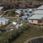
The popularity of Tasmania’s Three Capes Walk has had mainland state bureaucracies salivating at the prospect of emulating the feat, even though there’s no telling whether it is actually making money for Tasmanian Parks and Wildlife. Commercial-in-confidence provisions in the relevant leasing and licensing contracts see to that. The ‘iconic walk’ fairy dust is now being sprinkled liberally all over the place. And with the iconic walk sobriquet invariably comes the business case pressure to commercialise and privatise in some way.

Thus we have the Australian Walking Company succeeding in its proposal to build eco-pods in the Flinders Chase National Park on Kangaroo Island, in which to house its guided walking clients on the 5-day Kangaroo Island Wilderness Trail. Expect to pay around $800 per night per person for the privilege. In this case the word ‘wilderness’ is something of a marketing tool but there have been serious proposals by such companies to build luxury accommodation in more remote designated wilderness areas: an unsolicited (and unsuccessful) proposal to do so on the Kanangra to Katoomba (K to K) walk through the Kanangra-Boyd and Blue Mountains Wilderness areas a few years ago springs to mind.

Such proposals are concocted, oblivious to the fact that the phrases ‘wilderness lodge’ ‘wilderness resort’ or even ‘wilderness hut’ are all oxymorons. But most of our national parks are not declared wilderness and the legal restraints that apply are fewer.

In coastal southern Queensland, there’s a proposal to build 10 ‘eco’ huts sixty metres up the banks of perched Poona Lake near Rainbow Beach in Great Sandy National Park to facilitate commercial guided walking on the Cooloola Great Walk. This national park also encompasses k’gari (Fraser Island); it’s only k’gari’s protection as a world heritage site preventing such development there.

Meanwhile, Victoria has come up with the Falls to Hotham Alpine Crossing that will stretch an overnight backpack walk into a 5-day, 57-kilometre affair at the cost of many tens of millions of dollars. The consequent ‘low impact’ huts (with up to 10 two or three-person huts, a communal hut and two toilets at each site, this is more akin to a mini mountain village) are to be built at taxpayer expense but not available to the independent walker: the ‘preferred model’ is to lease them to a single private operator who would also operate the high-end accommodation and guided hiking package at around $800 per night.

Parks Victoria has already set its own precedent with the huts it had constructed at two walk-in campsites along the northern section of the new Grampians-Peaks-Trail. You can stay in these 4-person eco-huts so long as you employ the guiding and cooking services of either the Grampian Peaks Walking Company or Raw Travel and sign up for a 3-day guided walk: expect to pay around $900 each per night. When not being used by the two commercial operators (that is, most of the time), the huts lie unoccupied.

New South Wales has come late to the party but is busily making up for lost time. First up on the far south coast, the controversial Light to Light Walk upgrade, featuring two new huts. An earlier version of the proposal, modified after a public backlash, excluded independent walkers from camping at certain scenic sites and sought to force them to camp at the existing and less salubrious drive-in camp sites. The stay at the Green Cape lighthouse at walk’s end will be available exclusively to Light to Light walkers and will no doubt be bulk booked by commercial operators who will likewise seek access to the new huts on a bulk-booked basis.

At $56 million, the 4-day Dorrigo Escarpment Great Walk will also have 3 new (basic) huts and campsites and a swish new Rainforest Visitor Centre. It is unclear whether it will be publicly managed or not: the department website states, ominously, that detailed operational procedures and pricing are not yet provided.

No such ambiguity with the proposed Great Southern Walk between Kurnell and Sublime Point. This 67-kilometre walk traversing Kamay Botany Bay NP, Royal NP and the Illawarra Escarpment State Conservation Area, is already open for Expressions of Interest to find a suitable delivery partner even though no new infrastructure has been built yet. Once the new huts and campsites are completed, the suitable partner will ‘help run the guided walking and manage the new camping experiences using the new facilities’: more outsourcing to a private operator on an exclusive basis. The rationale for this – and I quote – ‘it … allows us [NPWS] to get on with managing our visitors and conserving the natural and cultural values of the national park.’ [Department of Environment website]

Apparently, managing walkers’ huts and campsites isn’t considered by NPWS to be part of managing visitors. If NPWS lacks the expertise to do so it should be recruiting skilled staff because the ‘provision for sustainable visitor or tourist use and enjoyment…’ is one of the legislated management principles under which it operates. You can bet that if a guided-walks operator is managing the new huts, their clients will get priority or even exclusivity, with independent walkers relegated to the camping platforms.

For something far more egregious, look to the plans for the long awaited and recently created Gardens of Stone State Conservation Area (SCA). No sooner had it been declared than a draft Plan of Management was released for public consultation. The problem with this slimline document was it had almost nothing of substance in it. All detail of what is being proposed for the SCA – a veritable theme park in the park’s ‘Lost City’ area – was devolved to a separate document: a draft Master Plan for the delivery of $50 million-worth of eco-adventure tourism.

The problem (or, more cynically, the trick) is that the master plan is a non-statutory document – it doesn’t need to be adopted by the Environment Minister, nor would it require public consultation to alter it; it could be changed at will. Along with zip-line courses, a via ferrata rock scrambling course and 4WD touring routes, there will be the multi-day hut-to-hut Wollemi Great Walk. No doubt, the huts, to be built with taxpayer funding, will again be effectively privatised through a long-term lease to a ‘preferred operator’, an all-too-familiar trope.

There are other ways of operating such long-distance walks that are still compatible with the high-end market. You can walk Victoria’s popular Great Ocean Walk the luxe way, staying off-park each night at the same luxury walkers lodge (midway at Johanna, which is not part of the park) and being transported with your daypack each day to the trailhead. Similarly, WA’s Cape to Cape Walk can be done in guided luxury, staying at Margaret River.

Kosciuszko’s new 55-km, 4-day Snowies Alpine Walk between Guthega and Lake Crackenback (Thredbo River) will be able to be walked self-guided or guided but staying at existing infrastructure at Guthega, Charlotte Pass and Perisher. Close to home, Shoalhaven’s soon-to-open 34-km Murramarang Coast Walk can be walked pack-free and with a roof over your head, staying either off-park (operators are already advertising guided package deals) or on-park at pre-existing accommodation, for example the cabins at Pebbly Beach, Depot Beach and Pretty Beach. But with bureaucracies feeling the political imperative to monetise the national parks estate in return for the sudden windfall funding for tourist infrastructure, this model seems to be on the wane. Put simply, there’s not enough money in it.

The argument is inevitably made that guided hut-to-hut walks increase equity of access by enabling people to complete such walks who would not otherwise be able to do so. This may be true in theory but in practice, the high costs of such guided walks in Australia preclude the majority of people availing themselves of the opportunity.

I recently attended a full-day symposium organised by Bushwalking NSW on Tourism in Protected Areas and not surprisingly, several of these case studies were discussed. It’s fair to say there wasn’t a lot of love in the room for commercial enterprises seeking exclusivity or for National Parks management seeking to outsource responsibility for managing the assets that are, after all, publicly owned and taxpayer funded.

So what is a reasonable stance to take on these issues? There is a (hard)core of bushwalkers who decry any roofed accommodation and related infrastructure ever being built in our national parks. They would hold to the idea that only self-reliant and self-sufficient walkers have any place venturing there on multi-day excursions. This is not what I’m advocating here. I don’t have an in-principle problem with huts in our national parks – either pre-existing or newly-built – if they are truly low-key, sensitively placed and having a low environmental impact. Huts have a particularly valuable place in more hostile environments and I’ve slept in plenty over the years. It’s the model that’s the problem. Given that our national parks and other such protected areas are all public land (unlike, say, European national parks), my first objection is to any form of de facto privatisation: giving commercial entities exclusive long-term leases on public infrastructure or on land on which to build their own.

I don’t object to paying a (modest) premium for staying in a basic hut rather than using an associated campsite. But there should always be a choice. Nor do I object to commercial operators providing guiding, cooking, pack transportation, food drops, trailhead client transport and the like under an appropriate licensing agreement. But such arrangements should be transparent, contestable and nonexclusive and the financial details should not be shrouded in commercial-in-confidence.

My biggest objection is to any attempts to mandate the use of huts, private or public, as a precondition for undertaking a multi-day walk a la the Three Capes Walk template. At the end of his presentation at the above-mentioned symposium, I asked a very senior NPWS manager why the Green Gully track – a 65-km walk in the NSW Oxley Wild Rivers National Park – is off limits to tent-based walkers. Self-guided walkers are required to move each day between the 5 pre-booked, six-person huts for which solo bookings are not accepted. The cost, though a small fraction of comparable commercial guided walks, is considerably higher than the Overland Track. I got a sheepish reply that this walk’s overly prescriptive regulation is an aberration, a mistake not to be repeated. I fear otherwise. Thank you to Rob Blakers for Three Capes Accommodation Footprint images.
Three Capes 9/11/15
Three Capes 9/11/15