main

Contacting Emergency Services

with the Emergency+ smart phone app

Some advice to consider regarding contacting Emergency Services from an experienced bushwalker and engineer.

The Emergency+ app is highly recommended for bushwalkers. It lists all the important emergency phone numbers – 000 (triple zero) of course; but also, the SES, Police assistance line, poisons information and many others. It also has a simple clear display of your location as a latitude/longitude which can identify your position anywhere in the world, which is of course important for bushwalkers as the usual “street and nearest cross street” location is not useful in the bush.

But there are some limitations and misconceptions about the Emergency+ app you should be aware of.​

​Firstly, in an emergency, if you dial 000 (triple zero) using the Emergency+ app it is no different to dialling 000 from a normal phone. It does not send any special information and it does not send your position to the 000 operator. You will still have to tell the operator your position, and that can be the GPS coordinates from the Emergency+ app if that is the best way to do it. On the Emergency+ app it gives your GPS coordinates in a box titled “Tell the operator your location” – you have to tell the operator your position as the operator cannot read it from the phone directly.​
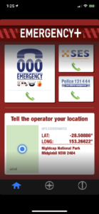
​Secondly, the Emergency+ app uses the GPS (or GNSS system to be more precise) in your phone to get your position. If the GPS is having difficulty in getting a position – maybe you are in a damp area, under a thick tree canopy or near cliffs – then the GPS will return the last position it got a fix on the position until a new fix is determined. This old fix could be anywhere you have been recently; maybe at home before you left, maybe on the drive to the start of your walk; but this fix will be displayed until a new fix is determined. The old fix could be wrong by kilometres, or even in the wrong country if you have just done an international flight!​

​To make sure the location fix it is displaying is a current fix and not an old fix there are two things to look at. The simplest is the little map next to the position. Check the maps shown is correct for where you are. But as this is a street map it is not very helpful in remote areas as there might not be any streets nearby so nothing will be shown.
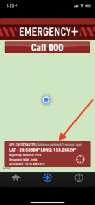
Page 2 or “+” page of app

A better way to check your fix is a current one is to go to the second page of the Emergency+ app (the “+” with a circle around it on the top or bottom bar) and in the red box at the bottom it says “GPS COORDINATES (Address updated XX secs ago)”. Make sure your address has been updated in the time you have been at your current location, and preferably only a few seconds ago. If it shows that your address has only been updated hours or days ago you should be cautious that the position it will display will be an old position which could be miles away.


Finally, remember that the position displayed on the Emergency+ app is just one way to give your position. If you know your position as a grid reference from a map, another GPS, a street address or even some nearby landmark then feel free to use that to give your position to the 000 operator. Speak slowly but remember that all calls to 000 are recorded. Any position reference is acceptable, just make sure it is accurate.

Get the Emergency+ App here now

Tyagarah Tea Tree Lake Beach Walk

As we all know during November and December 2019 prolonged drought and hot dry conditions lead to devastating bushfires along the east coast of Australia. The scale of the ongoing climate emergency has been unprecedented with disastrous consequences for the environment and native animals, people living in the bush, volunteer firefighters defending our communities and air quality in our cities and towns.

The resulting closure of National Parks has also meant lean times for those of us wanting a bushwalk! A quick glance at the Northern Rivers Bushwalkers (NRBC) calendar in November 2019 revealed a list of walks cancelled due to fire. Given this it seemed that beach walks provided the perfect alternative walk solution. So when Michelle from the NRBC organised a summer celebratory walk from Belongil Beach to Tyagarah Tea Tree Lake my sister and I were really keen to participate.

We were assured that the Tyagarah Tea Tree Lake was ‘safe’ with all visitors once again clothed and decent thanks to the Byron Shire Council cracking down on nudity and inappropriate behaviour in the area. Read here about the Lake’s controversial history.

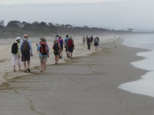
Our walk started early at the Treehouse on Belongil near Byron Bay. After a quick coffee we headed up the beach for the walk to Tyagarah Beach and the Lake. Along the way we passed the opening to Belongil Creek and were told that before the drought this section of beach was often a creek crossing. Sadly this was no longer the case with water at very low levels and a great expanse of firm sand across the mouth of the creek.

Eventually we reached Grays Lane, a dirt road which leads to the Lake through Tyagarah Nature Reserve. The Reserve protects a number of coastal endangered ecological communities and threatened plant species which you can read more about here. After a short break in the picnic area we proceeded through the Reserve to the Tyagarah Tea Tree Lake.

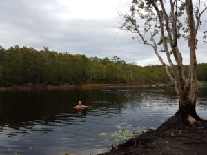
On reaching the Lake our breaths were taken away by its stunning beauty and peaceful serenity. The Lake is framed by picturesque native coastal bushland with its cool waters stained by the healing oils of the surrounding tea trees. We settled down next to the Lake for a picnic lunch with many of us declaring we would wait to swim in the ocean on the return journey despite being hot after our walk. However once one person started swimming in the lake its appealing coolness was impossible to resist and soon enough many of us were gliding and relaxing in the water.

My sister Michele enjoying a cool swim in Tyagarah Tea Tree Lake

As we started the walk back along the clothing optional section of Tyagarah Beach the nudist visitors were in their full glory basking in the hot sun.  My sister and I couldn’t help but notice with amusement the stark contrast of our bushwalking posse outfitted from head to toe in protective gear trudging dutifully through the assortment of cavorting naked sun worshippers!

Our walk was approximately 9km in distance once we had returned to the Treehouse on Belongil.  Overall it was a very enjoyable morning out with a satisfying walk punctuated by a refreshing swim and the opportunity to visit new areas along the way. Thanks very much to Michelle from NRBC for organising this alternative beach walk event.  Click here to find out more about the NRBC and what activities are on.

Trek 100km along Victoria’s Great Ocean Road – join Diabetes NSW & ACT’s adventure of a lifetime!

Celebrating its sixth year this year, the trek covers 100km from Apollo Bay to the Twelve Apostles across Victoria’s rugged coastline. Lace up your hiking boots and join Diabetes NSW & ACT for this seven day, 100km trek along the Great Ocean Road. Set yourself a challenge for fun, fitness and fundraising.

The Great Ocean Road Trek runs over five days and hikers say they take inspiration from the breathtaking scenery of Victoria’s rugged coast along the way. Connecting to nature, observing koalas in their natural habitat and discovering the full beauty of the region’s abundant flora and fauna is part of the daily experience. Participants comment on the spectacular beauty of the trek and their delight at hearing echoes of birdsong as they wind their way through forests, rocky shores, deserted beaches and windswept clifftops.

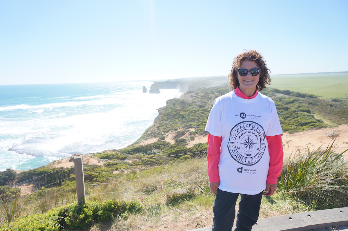
Our team took the opportunity to interview Beverley on the experience – from signing up through to conquering the five day challenge in October this year. Beverley said “I often wondered in recent years, if ever I was to be challenged, could I rise to the occasion?” Beverley went on to disclose to us the contemplation process prior to embarking on the Great Ocean Road Trek adventure. “I knew it would not be easy, as I would have my age against me (68), and type 1 diabetes to contend with. When I saw the article on the 2018 trek, I knew it was time to answer those nagging doubts I had!” Beverley recalled.

Beverley’s adventure of a lifetime – 100km across the Great Ocean Road!

Beverley said her favourite moments included witnessing the colour of the ocean shift from grey to blue, the cliff views and the comradery that comes with finishing a challenging endeavour with likeminded individuals.

“As a team, we helped each other, laughed with each other and deepened our connection, as we trudged as a group further along the length of the coastline.”

The elation didn’t stop there for Beverley and the intrepid team. Her excitement at reaching the Twelve Apostles is contagious. “As we reached the final hilltop, the summit seemed to be silhouetted against the vast, blue sky. I felt like the twelve apostles were waving to us upon our arrival. An incredibly joyful feeling!” said Beverley.

Are you ready for an adventure of a lifetime?

Expressions of interest for 2020 are open, submit your registration by 31st January and save $150 on early bird offering. Don’t miss out, simply email fundraising@diabetesnsw.com.au or head to https://diabetesnsw.com.au/great-ocean-road-trek/ to find out more


Alternative activities

Have park closures or extreme weather conditions cancelled your plans?

Here are oodles of awesome alternate activity ideas.

No need to do them alone! Meet the group you were planning to head outdoors with at a cafe or library instead. Have fun and feel good about these ‘indoor adventures’ together!

  1. Find and schedule the walks and activities you want to lead in the new year
  2. Not a leader yet? Call a current club leader and ask if you can buddy up to learn to lead – they are friendly folk!
  3. Read the Bushwalking Manual – a great read for everyone doing all kinds of outdoor adventure 🙂
  4. Get started on a first aid course – you can do the pre-reading online for free! https://pfa.stjohn.org.au/
  5. Meet up with a club buddy to plan a club activity together in the new year
  6. Read our Risk Management Guidelines – it is truly worthwhile
  7. Learn all about our insurance – consider becoming an insurance officer – ask us how
  8. Start planning and coordinating a risk management training session for your club. You don’t have to know it all – ask club members with each special expertise to talk on their bit.
  9. Run a navigation theory session for your club and friends
  10. Learn how you can help our suffering wildlife: WIRES & NWC
  11. Write to members of parliament to ask for a climate action leadership:
    1. Federal Ministers.
    2. NSW Members.
    3. ACT Members.
    4. Tell them you’d rather be bushwalking or hiking, healthy and active, than sitting indoors because of extreme weather events!
  12. Brainstorm how to engage more youth in your club
  13. Organise your photos and send in some great ones to us so we can share them through our newsletter and website – email to admin@bushwalkingnsw.org.au.
  14. Contribute your photos and descriptions of the great walks of NSW & the ACT to manual@bushwalkingvictoria.org.au
  15. Check out all the resources available for you on the Bushwalking NSW website
  16. Ask your club management committee if they need any help
  17. Sign up for a Bushwalking NSW working group
  18. Help Bushwalking NSW develop a Hot/Extreme Weather Policy that can help all our clubs – contact us now!
  19. Schedule club social events for the new year
  20. Look for great speakers for next year’s club meetings
  21. Call friends affected by extreme weather and learn how they are doing
  22. Prepare you home for fire as a group – going to each member’s home to clip and clear.
  23. Learn how to plan and prepare for fire
  24. Help out others affected by natural disasters
  25. If you haven’t done it yet – put your Bush fire survival plan at the top of your list!

And once you’re done. Pat yourself on the back and thank your team 🙂

Adapting to climate change

Our changing climate is bringing new risks which bushwalkers and outdoor adventure enthusiasts should keep in mind whenever planning trips, and whenever we head out on our adventures.

This page gives a quick summary of what to consider. Click through to the relevant authority for detailed information, alerts and to subscribe to alerts and news from each authority.

Extreme weather

The consequences of our changing weather are:

  • More National Park/State Forest/etc closures + more track closures – due to:
    • Threat of fire
    • Damage from fire/flood making tracks unsafe and/or impassable
  • Dehydration & heat stroke of greater concern in hot summer days
  • Increased chance of flooding
  • Poor air quality making prolonged exercise inadvisable (see below)
  • A new Fire Danger Rating

That is why it is important for you to check conditions before you head out. Also monitor conditions for rapid changes. For example, on high fire danger periods/days, or during extreme rainfall, etc.

Avoid remote areas during bushfire conditions. Look at the forward forecast fire ratings and weather before multi-day trips and err on the side of caution.

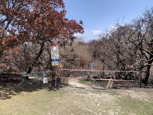
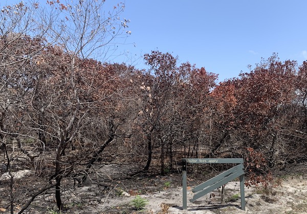
National Parks closed and damaged by fire

Air quality & health

Air pollutants, including smoke from bush fires, can be harmful to our health and so check air quality forecasts before you head out.

NSW Department of Planning, Industry and Environment states that we should all reduce heavy or prolonged exercise when the Air Quality Index (AQI) is >150.

However, The Climate and Health Alliance have now declared: “There is no safe level of air pollution. The higher the level of pollution, the more hazardous the risks to health. Bushfire smoke is particularly hazardous because of the high levels of tiny particles (PM2.5).”

You can check the current and forecast air quality here: https://www.environment.nsw.gov.au/aqms/aqi.htm

And find out what the AQI colours mean for your activity here:

https://www.health.nsw.gov.au/environment/air/Pages/aqi.aspx

Leaders should cancel activities to areas likely to be affected by poor air quality.

Fire Ratings

Note that a new Bush Fire Danger Rating exists called “Catastrophic”. If a Catastrophic warning is issued when and where you are planing to be in the bush, you should cancel your planned activities and move to a place of safety.

A “Catastrophic” rating may be issued in advance so always check the forecast if you are planning/heading out to a multi-day activity.

The current RFS advice for what you should do if the Bush Fire Danger Rating is “Catastrophic” is:

  • For your survival, leaving [the area to be affected] early is the only option.
  • Leave bush fire prone areas the night before or early in the day – do not just wait and see what happens.
  • Make a decision about when you will leave, where you will go, how you will get there and when you will return.
  • Homes are not designed to withstand fires in catastrophic conditions so you should leave early.

See the RFS for full details of Bush Fire Danger Ratings including “Catastrophic”: http://www.rfs.nsw.gov.au/fire-information/fdr-and-tobans?a=1421

Learn more about Bush Fire Danger Ratings and Total Fire Bans here: https://www.rfs.nsw.gov.au/fire-information/fdr-and-tobans

Fire damage

Every time you head out – check:

To manage these hazards always check before you head out:

Hot Spots

These new tools may indicate fire activity, however the site creators say they are “not to be used for safety of life decisions. For local updates and alerts, please refer to your state emergency or fire service.”

Always remember, that this information is only as updated when a satellite passes over the location you are viewing. IE: not that often.

https://firewatch-pro.landgate.wa.gov.au/ (seems to be more current just from our casual observation)

https://hotspots.dea.ga.gov.au/

Alerts

  • Bushwalking NSW does not pass on alerts. Instead, we recommend you sign up for alerts directly with the relevant authority
  • Bushwalking NSW periodically remind our newsletter subscribers that people and clubs should check for alerts:
    • In anticipation for activities
    • Before they head out
  • Sign up to our newsletter at the bottom of this page and here

Subscribe to updates

  • We encourage all people engaged in outdoor adventure to sign up to receive alerts from the relevant authorities.

Clubs

  • We suggest clubs consider how they are communicating with their members when conditions become hazardous or extreme.


We hope this brief guide helps you all to continue to enjoy safe and successful outdoor adventure in our beautiful natural places!

A bushwalker’s two day crawl before rescue

In kindly and candidly sharing a very painful and harrowing ordeal, a club leader has given us some important points to reflect upon. Every time we head out.

In mid-September, Neil Parker (54), an experienced leader for Brisbane Bushwalkers, was conducting a solo recce (reconnaissance walk) of Cabbage Tree Creek near Brisbane, Queensland.

While alone, Neil fell down a 6-metre waterfall, fracturing both his leg and wrist. He then crawled for two days, to reach a clearing, in the hope of a search team finding him. Excruciating.

He did not have a PLB*, and did not leave trip intentions.

It is rare, but sometimes things go wrong.

This article describes the incident: https://www.abc.net.au/news/2019-09-18/mt-nebo-bushwalker-crawls-to-safety-after-fracturing-leg-wrist/11522794

Neil’s personal account is well worth a listen:

https://www.facebook.com/ABCSunshineCoast/videos/2434513696831834/

We encourage you to reflect on Neil’s experiences.


Some of our reflections are:

  • Take a PLB*, especially when going solo. Even for short walks. Register it with AMSA.
  • Always Leave Trip Intentions with a reliable person.
    • That means telling someone your detailed trip plans, and when you are due to return. Plus it means that person calling the police if you haven’t returned at the time you said you would. Always call your responsible person on your safe return.
  • Neil is saying the right things in his interview so he is clearly very knowledgeable and experienced. This helped him save himself. So:
    • Join a bushwalking club to learn a wealth of invaluable knowledge and experience in all kinds of adventure. For a very low cost! Have a great time discovering new places. and new types of adventure activities.
  • Neil didn’t panic and had a good first aid kit.
    • He could have also included a sam splint in his kit – it is a much better for dealing with a fracture than walking poles or tree branches.
  • Neil demonstrates how important it is to take first aid kits seriously and keep them well-stocked. Even for a short, familiar walk.
  • Neil took warm clothes and a space blanket on a short, local walk, in a warm climate. And needed them.
    • Consider also a cashmere beanie – superb warmth-to-weight ratio.
    • The space blanket kept him warm and could help rescuers see him.
    • Regularly replace your space blanket – they can de-laminate over time.
  • Neil also took a head torch, his mobile phone and energy-packed snacks. He needed all of these too.


If you haven’t watched it yet, do watch Neil’s personal account:

https://www.facebook.com/ABCSunshineCoast/videos/2434513696831834/

Pass it on

All outdoor adventures can benefit from Neil Parker’s experience, so please pass this onto them.

For Clubs

We’d also recommend that club committees devote some time to discussing Neil Parker’s experience and insights, and the implications for each club’s risk management.

We advise all club members to put all exploratory (recce) trips on their activities program. This is the minimum requirement for an activity to be covered by our Bushwalking Australia Insurance.

We also recommend all clubs have: (1) a way of recording trip intentions for all activities, (2) a way of checking that all participants have returned from their activities when they said they would, and (3) a person who will call the police if a person/party haven’t returned when they said they would.


We wish you all the best out there. And we wish Neil Parker a rapid and full recovery.


*PLB = Personal Locator Beacon

Tips for growing your club

The topic at the recent Bushwalking NSW AGM was ‘How to grow your club’, providing an insight into how one club substantially grew from 50 members to over 300 over a period of a few years. Some of their ideas are paraphrased below. For more information and suggestions on club management see http://www.bushwalkingnsw.org.au/club-management/

You can listen to the audio which inspired this post. (Works on Chrome and Firefox. Apologies for the rough recording – with patience you will hear the gems buried within!).

Soft management

Allow the committee to handle the running of the club, rather than having boring and contentious general meetings where members wrestle over every last detail of its operation. Reserve member’s meetings for socializing, educating, talks and slide nights etc. Give the committee the authority under the club’s constitution to handle the day to day affairs of the club, including making decisions, finances, policies and procedures.

Focus on activities- not committee meetings. The committee should meet the absolute minimum times per year that is needed to organise the club program and fulfill its legal requirements. Under new Incorporated Associations law it is permissible to hold electronic meetings e.g. Skype, conference calls and committee voting by email.

Design the committee structure around roles. Don’t have inactive ‘ordinary’ committee members. Each committee member should have a defined purpose and role. You may need to change the constitution to do this.

Ensure that committee members change regularly by limiting the number of times a member can stand for a particular role. This prevents stagnation and burnout and brings fresh ideas onto the committee agenda.

Make it easy to participate

Clarify processes and procedures and document them so that others know what they should do and how to do it. e.g. how to join, how to become a leader, how to arrange an activity.

Remove obstacles from member and visitor participation e.g. paperwork.

Put your documentation and programs on your website so that everyone can access the information.

If members show an interest in a particular activity or idea or have a suggestion to make, ask them to lead the activity or implement the idea.

Don’t wait for people to volunteer; ask them to do something and give them assistance to carry it out. e.g. buddy potential leaders.

Feature program changes and late-notice activities on the website and encourage members to check it regularly.

Promote the club

Give members club business cards to hand out to interested parties, rather than bulky, old-fashioned leaflets.

Ensure the club website has a current design and feel and is easy to navigate.

Make visitors feel welcome and ask them to return.

Don’t get hung-up about age

Understand your Target Audience. Some clubs are youth oriented, such as university bushwalking clubs, some have all age groups in their membership, while others are composed of 50+. Don’t worry that your club has no members under 50 years old. People’s lives have a natural cycle. After they have had children and the demands of raising a family are most over, then they will start to look for new activities as they enter their fifties. Target these people for membership. The most important point is that you cater to their needs and continue to attract new members in that age group.

It is natural to have a turnover of membership or around 15-20% annually, so don’t worry when people resign. It is more important that you replace departing members.

Members don’t have to be locals. Having intercity, interstate or international members can open possibilities for club holiday activities utilising local knowledge.

The program

A diverse program, with a broad range of activity types and grades, will attract a diverse range of members, increase membership and increase activity participation.

Consider posting your program on the website so that both members and potential visitors can see the latest activities on offer.

Most clubs now email the program rather than printing and posting. Consider offering a monthly emailed program instead of the traditional quarterly. This means the Program Secretary’s duties are spread evenly across the year rather than clustered in a couple of months. It also means leaders don’t have to commit to an activity 4-5 months in advance, Late notice activities can be easily added to the website or sent out as an email alert.

Be social

Joining a bushwalking club is not just about outdoor activities. It is also about socialising. It’s okay for a bushwalking club to run purely social events with no walking involved. Create opportunities in the program for members to socialise, such as; planning for coffee at the end of a bushwalk, restaurant nights, attending fun events. The result will be increased group cohesion, increased membership, a spirit of volunteerism and higher participation in bushwalks.

Chardon Award 2019

Two bushwalkers were recognised with the 2019 Chardon Award at the Bushwalking NSW (BNSW) AGM on 20 August.  See the notes below for comments on these worthy recipients; Jim Callaway and Linda Groom.  In 2017 BNSW established the Chardon Award to recognise bushwalkers who have made a special contribution to bushwalking.

LINDA GROOM notes

Linda comes from a Queensland bushwalking family who studied at the University of Queensland before moving to Canberra around 1975.  Since then, she has been a very active walker in Canberra Bushwalking Club where, among other things, she has served two terms as President but now is the current Walks Secretary.  She has been honoured with life membership of CBC.

So, Linda is well recognised within CBC but now Bushwalking NSW wants to recognise her for a contribution to bushwalking with the Chardon Award.  Like many others the author is well aware of the impact of feral horses in the Snowy Mountains.  The difference is that Linda sought to raise awareness of this damage by a long bushwalk.  She was the driving force in a highly publicised event where walkers went from Sydney to Kosciuszko National Park.  Bushwalkers from towns along the route would join her for short sections to swell the numbers.  Along the way these walkers spoke to the general public and where possible local MPs about the impact of feral horses in the Snowy Mountains.  She presented a report of this walk as the guest speaker at the November 2018 General Meeting of BNSW.  This was her second visit as a guest speaker when she spoke of exploratory bushwalks in Central Australia.  A remarkable achievement and definitely worthy of recognition with this award.

JIM CALLAWAY & BNSW notes

On 30th January 2018 my wife and I represented BNSW at the Engadine Catholic Church for a Mass of Thanksgiving for Jim Callaway.  We joined many other bushwalkers for this memorial service.  Over many years we had known Jim as part of Bushwalking NSW (BNSW) but he eventually also became a good friend.  During his time of distinguished service to BNSW he represented the Catholic Bushwalking Club and Sydney Bush Walkers.  In his prime, as a bushwalker, he was known to avoid tracks to go off track at a pace that dubbed him “tearaway Callaway”.

From newsletter archives of BNSW I can say he was Treasurer from 1978 to 1987.  He kept a tight rein on finances as BNSW had an historically low affiliation fee.  In 1992 he was Public Officer for the very new Confederation of Bushwalking Clubs (now BNSW).  Before serving as President in 1998 & 99 he was the 1997 Vice President, a role he took up again from 2000 to 2004.  Records from 2004 are less clear but until the end of 2014 he was continuously on the Management Committee of BNSW (while living at Heathcote; true dedication)

Jim Callaway is definitely worth remembering as a special bushwalker since he gave more to bushwalking than bushwalking gave to him.  On behalf of BNSW I would like to express our thanks for his dedicated service to BNSW.

Keith Maxwell.


Packing and planning for the best trip in Europe

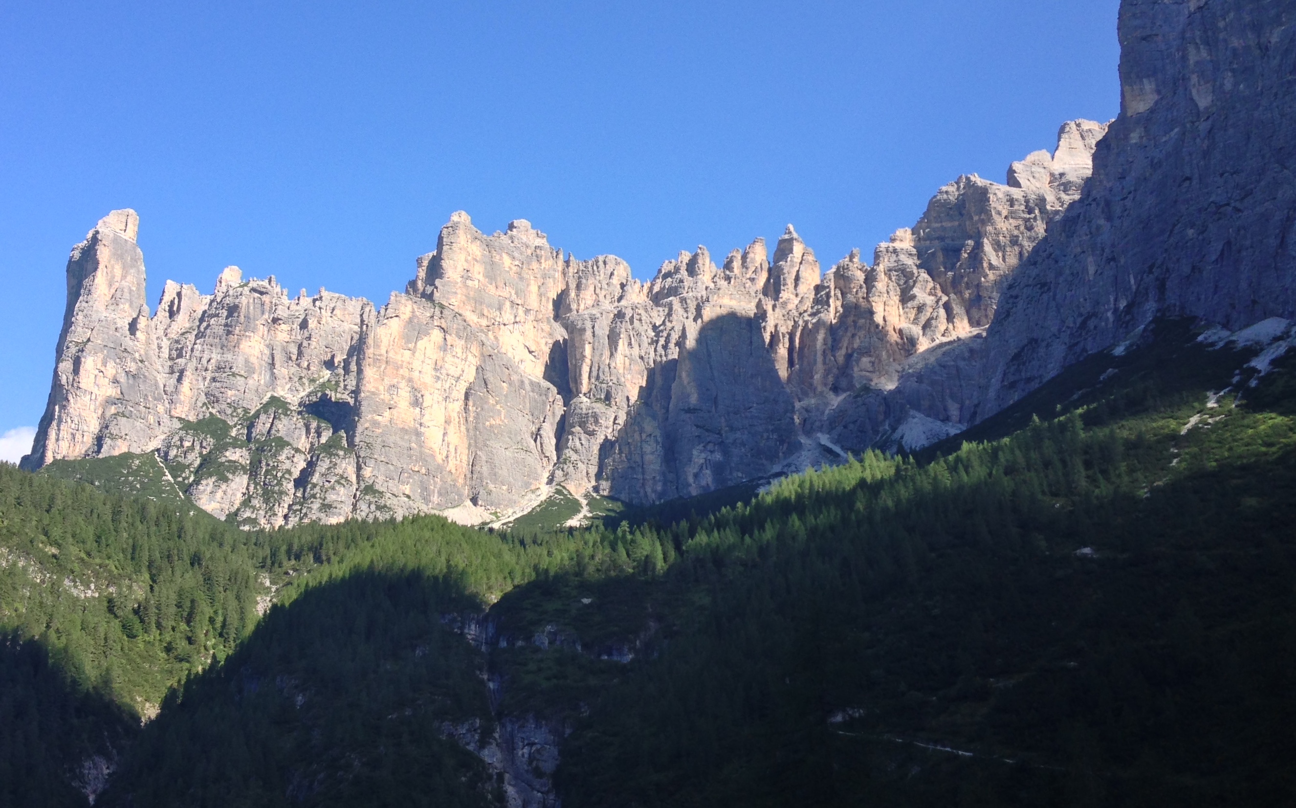
One of the wonderful things about walking in Europe is the accommodation available to walkers.  Amazingly, this remote mountain refuge (Rifugio Pramparet), on stage 9 of the most beautiful walk in Europe, had the most interesting and delicious food of all rifugios on the trip!


Local communities and mountaineers have been walking these routes for generations. So to make it all a lot easier, they have built places to stay called rifugios (refuges). Rifugios provide bunkbed accommodation, a cooked breakfast and dinner, alcoholic beverages, cakes, and a packed lunch. To top it off you can often even get a shower … though some of them are cold!


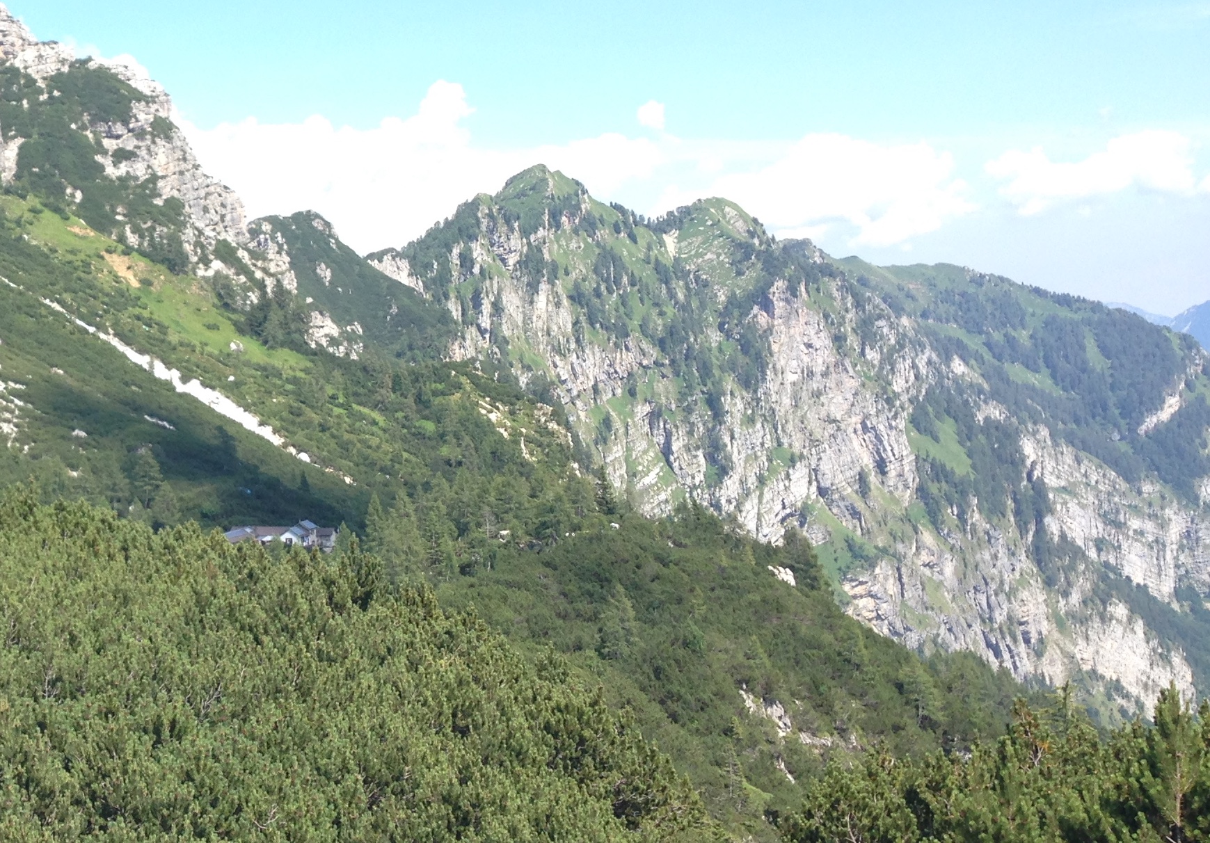
All this in a cozy hut, high in the mountains surrounded by amazing beauty. The speck in the middle of this incredibly steep forest is Rifugio Vassoler:

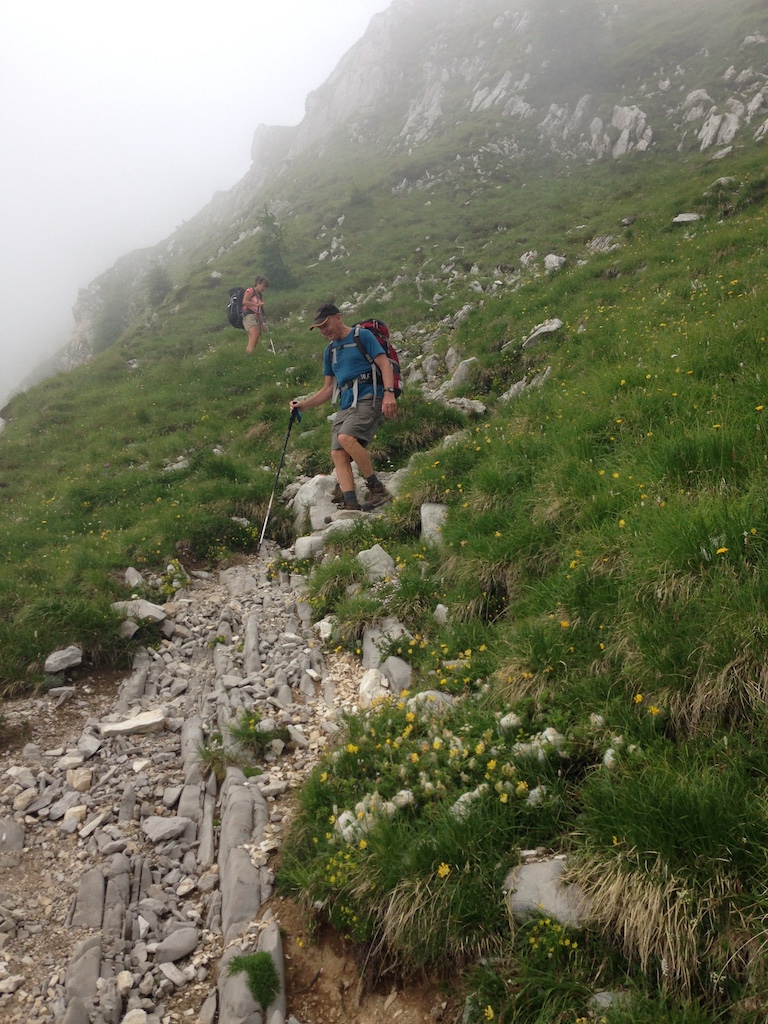
All of these luxuries can reduce the weight of your pack to a sleeping sheet, towel, your walking snacks, toiletries, and the gear you will need for the wide range of weather and track conditions you can encounter in the mountains. But don’t forget your walking sticks – they are essential equipment for the Alta Via 1 walk which is unbelievable steep in places:

The best way to learn how to lighten your pack is by joining a bushwalking club like the Coast and Mountain Walkers (CMW) and heading out on some overnight walks with them. Super-experienced bushwalking club members, like those from CMW, have so many tips and tricks for keeping you comfortable and happy in all conditions out in nature 🙂


Having that kind of experience behind you means you’ll enjoy your trip so much more.  Nothing beats knowing how to thrive in the wild. It’s like opening a doorway to a world of adventure.
The other thing you can learn in a bushwalking club, is how to pack a light meal and save yourself some money for more trips like this! Then lunch can be a picnic spread out in the middle of all that beauty!
Here is where you can find a club near you that will help you discover the most beautiful places to walk in NSW, the ACT and the world: our clubs.

Walking Volunteers Map Greater Sydney

the walking volunteers

Walking Volunteers Map Greater Sydney

The Walking Volunteers (WV) were formed in 2004 when the North Sydney Walking Volunteers and the Hunters Hill Walkers came together to walk and map a continuous walking route around Sydney Harbour and along the coast from Barrenjoey to Port Hacking. You can see most recent maps here.

The group worked with the Department of Planning, councils, community groups and the Sydway Mapping Division to prepare nine brochures for this continuous walking route. Over 400,000 of these were printed and distributed. The brochures were also available as a download from the Sydney Coastal Councils Group web site which received over 30,000 visitors a month including 2,300 from overseas. The Sydney Harbour & Coast maps were also available as a free App (Sydway Walker) and over 270 of these apps were downloaded every month.

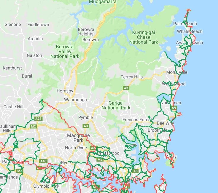
Barrenjoey to Parramatta

Maintaining a supply of up-to-date printed maps has proved difficult so the Walking Volunteers decided to adopt a ‘digital’ solution. Since 2014 they have been re-walking their routes, mapping them on GPS, ‘normalising’ them with Google Earth and loading onto GoogleMyMaps to provide walkers with an online, scalable walking map of the Sydney metropolitan area.

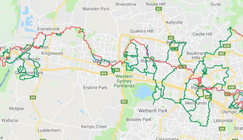
The WV maps are now structured to feature the main continuous walking routes (shown in red) focussing on the coast, harbour and river with links to the Great North Walk and the Federation Track. Their most recent project has been the establishment of the Great West Walk from Parramatta to Penrith and Katoomba that links major green spaces like Parramatta Park, Western Sydney Parklands and Wianamatta Regional Park with Blue Mountains National Park and provides one-day walks from station to station on the Western Railway Line.

Parramatta to Penrith

Complementing these main red routes are loops and links, shown in green, spreading into adjacent neighbourhoods for shorter local walks and connections to transport, community nodes and points of interest.

Whenever possible. the routes identified are existing walking tracks or paths built by councils, National Parks and other land managers. In places the maps indicate future projected routes and these are indicated in blue.

The project is ongoing with the aim of providing a metropolitan-wide walking network in line with the government’s concept of a Green Grid linking the city’s green spaces.

Using the Maps

You can zoom in to whatever scale you wish and print off whatever area you are interested in, using the Snipping Tool. The map may also be downloaded onto your smartphone or tablet.

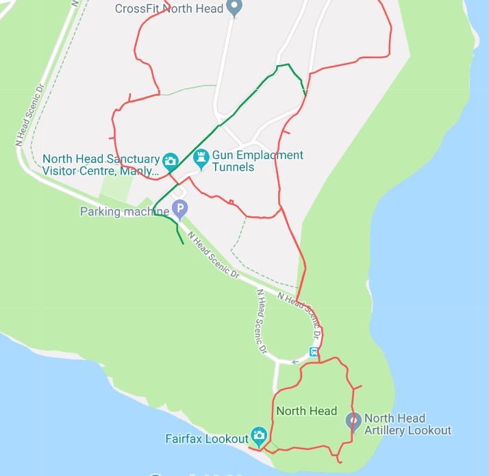
North Head

Download

To download the map just click on this link:-

https://drive.google.com/open?id=1WPb6QnNn9Wfgr61qiv6dPVKW2SI&usp=sharing

Personal Computer

Just click on this link and it will open. Use the +/- button in the bottom LH corner of the map to zoom into any scale that suits you. If you want to view the map in Satellite mode, use the slide on the LH panel and slide down to the satellite button in the LH corner of this panel.

The red lines on the map are the main walking routes. The green lines are the local links and loops that are so important to local walkers. The blue lines are future walking routes. There are also layers for:

  • Toilets/water fountains
  • B-line Bus Stops on the Northern Beaches
  • T-way Bus Stops in Western Sydney

Just click the box on these layers when you need them.

Smartphone/Tablet

You can also download the link onto a smartphone or tablet:-

On an Android phone (Google, Samsung, LG, Sony, HPC, Huawei, Xiaomi, Acer and Motorola) click on this link. You may be asked if you want to open the map in Google Maps. If so, enter ”Y”. If it doesn’t ask you, close the direct link and:-.

Click on the Google Maps app .

Tap Menu   Your Places  Maps.

Tap the map “Sydney Walking Tracks” which should now be on the Maps menu

You will now be able to follow any walking route as it will show you your location on the map,


On an Iphone or Ipad just click on this link and the map will open but it will not show your location on the map.

Feedback

We would appreciate any feedback on the app or the walking routes. Also, please feel free to pass on the link to anyone who might use it.

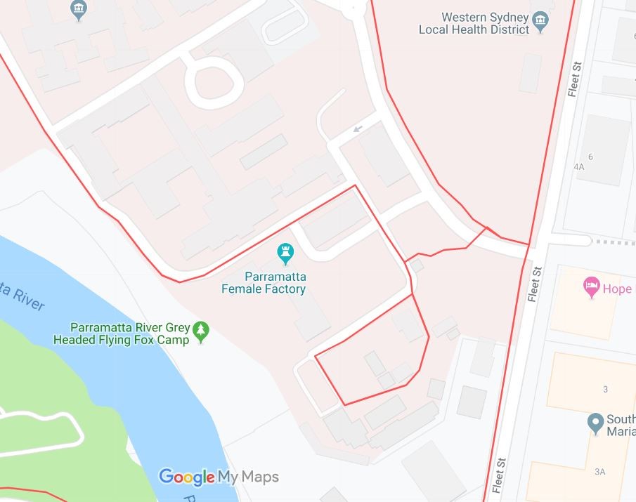
Parramatta Female Factory

The Walking Volunteers