NSW NATIONAL PARKS & WILDLIFE SERVICE
Summary of workshop outcomes June 2021,
Blue Mountains National Park & Kanangra-Boyd National Park Draft Plan of Management
Background
The NSW National Parks and Wildlife Service (NPWS) is developing a new plan of management for Blue Mountains National Park and Kanangra-Boyd National Park to set long term directions for the management of these national parks.
NPWS facilitated 4 workshops between 4 and 6 June 2021 to elicit stakeholder views and feedback on a range of matters, including:
• management of adventure recreation activities, including abseiling, canyoning, rock
climbing and slacklining
• management of recreation in wilderness areas
• management of key visitor sites.
Feedback on each of these discussion themes and other issues is summarised below. In this document, NPWS has endeavoured to reflect the feedback provided by workshop participants as accurately as possible. The points listed below do not necessarily reflect the views of all workshop participants.
2
Adventure recreation
General
• NPWS should use existing user groups to reach out and educate new users – e.g.
climbing gyms, outdoor clubs, university clubs, education groups.
• Visitors to the parks value the experience of being in the park and are concerned about
their own safety.
• Environmental sustainability and visitor safety are often compromised when large
groups are involved in adventure recreational activities.
• The focus of management should be on proper risk management and auditing, rather
than exclusively on limiting group size.
• The Australian Adventure Activity Standards (AASs) represent significant work and
thought by industry professionals. As such, NPWS group size limits should align with
these as much possible. Activity-specific Good Practice Guides (GPG) provide
recommendations about group sizes.
• One organisation represented at the workshop highlighted that compulsory adoption of
AAS standards and the GPG was not supported.
• Clubs are generally well managed and concerned about risk. They rely on selfregulation because they are not sufficiently resourced to adopt additional responsibilities
for the management of their members.
• A participant described the group size limits set by NPWS as generous.
• One business highlighted that they may use smaller groups than allowed.
• Improved communication methods are required to disseminate information about the
rules for each activity (e.g. a broader range of social media platforms, different
languages etc.).
Abseiling
• Maintaining a group size limit of 8 participants (and one guide) was appropriate.
• For multi-pitch abseiling, a reduced group size limit of 4 participants (and one guide)
was more appropriate.
• Larger group sizes were generally not appropriate but could be feasible at specific sites.
Canyoning
• The ‘canyoning community’ is working on a best practice document that addresses
environmental risk, cultural risk, and safety risks. This document can be provided to
NPWS.
• Maintaining group size limits was necessary to maintain individual and group safety and
to minimise any environmental impacts.
• Social media is motivating participants with insufficient skills to undertake the activity.
There may be opportunities to utilise social media to promote safety messages.
• Some people are attempting canyoning with limited experience and without the support
of a club.
• Group size limits should be conservative and appropriate for the canyon. A group size
of 10-12 was considered too high.
3
• Use of a booking system was supported at popular sites.
• Group size limits should apply to both commercial and non-commercial groups. Guides
help to reduce impacts and therefore should be allowed as an addition to the group size
limit.
• There should be a cap on total group numbers (commercial and non-commercial) per
canyon, per day, to manage current and future use.
• NPWS should consider adopting management strategies like those used by the US
National Parks Service.
• Education providers could benefit if they were licensed as commercial tour operators.
This would enable them to access improved operating arrangements including use of
the DigiRez booking system.
Rock climbing
• Top-rope climbing should have the same group size limit as applies to abseiling.
• A group size limit should be 4 or 5 participants per roped party.
• Bolting in the parks is an ongoing issue of concern. It was suggested that an updated
bolting policy and/or further discussion with NPWS is required. It was recommended that
the QLD Government’s approach to management should be considered.
• There have been some changes in group behaviours in recent years (for example,
visitors playing music when out in the parks).
• Group size limits should apply to both commercial and non-commercial groups. As
guides help to reduce impacts, they should be allowed as an addition to the group size
limit.
• The current approach to managing bolting/anchor points is not working. Further
engagement is needed to increase self-regulation, minimise impacts and maximise
safety.
• It was acknowledged that risk management was a complex issue and beyond the scope
of the plan of management to resolve.
• Australian Climbing Association has a climbing database (The Crag) that could be
utilised to improve communication with climbers about specific sites.
• Rock climbers should not be a source of revenue.
• Any plans to apply zoning for different types of climbing will require further consultation
with climbers.
• Education is needed for rock climbers on how to manage their waste.
Slacklining
• Slacklining was defined as the temporary use of trees in disturbed areas such as visitor
precincts (camping areas or day use areas where there isn’t high visitor traffic)
• Highlining was defined as the temporary use of cliff features and existing anchors/bolts
(rock climbing) for traversing on a safety line across airspace.
• There is interest in both recreational-based slacklining and event-based slacklining.
• The Australian Slacklining Association has established a code of conduct, fixed anchors
guidelines and guidelines regarding airspace safety. There is also an Adventure Activity
Standard in place.
4
• Slacklining is an emerging, legitimate adventure activity both in Australia and
internationally and it is therefore appropriate that NPWS makes provision for the activity
in the plan of management.
• Issues include impact on ecologically sensitive sites, the potential for noise pollution
(from webbing), air space /aviation safety, impact on scenic values and damage to
trees.
• Limits should apply on the duration of slacklines (e.g. 1 day).
• Variations of the activity include water-lining, yoga-lining, and trick-lining. Parks are not
a major focus for these activities.
• The strategies used by NPWS to manage other adventure recreational activities should
be sufficient to provide for the safe and sustainable authorisation of slacklining.
Recreation in wilderness
General
• A group size limit of 8 should be retained.
• Guides actively manage group behaviour. For this reason, the allowance of 2 guides for
commercial tour operators should be extended to educational groups.
• There is a need for active management in response to degradation around Burra Korain,
Dex Creek and Mobbs Swamp camping areas.
• Divergent views were expressed about the introduction of toilets and other infrastructure
to manage impacts. Most participants were supportive of the establishment of minimalist
and carefully designed infrastructure (including toilets), provided this was part of a more
holistic strategy which sought to avoid infrastructure development wherever possible.
Several participants highlighted the need for sound evidence before infrastructure
development in Wilderness areas is considered.
• The requirement to book all camping areas limits the freedom of individual choice and
requires all camping to become a pre-planned activity (rather than a spontaneous one).
• Designation of campsites and access via a booking system may be necessary.
However, the designation of campsites should not restrict options for walkers that still
wanted to enjoy dispersed bush camping.
• Information and education should be retained as the primary strategies for preserving
wilderness values.
• Information for walkers about wilderness boundaries should be improved as many
visitors don’t know when they were entering a wilderness area.
• The risk of exceeding the carrying capacity of wilderness areas was a major theme of
discussion. It was highlighted that social media and the promotion of wilderness
experiences (especially during peak visitation periods) presented a risk to wilderness
values.
• Marketing should avoid promotion of wilderness experiences during periods of peak
visitation.
• The parks are significant for the preservation of wilderness values, and the unique
experiences that these wilderness areas provide.
• The plan of management should include strategies to retain opportunities for people to
enjoy true wilderness experiences in the long-term and that these strategies should
seek to prevent the application of more interventionist strategies (e.g. toilets) in the long
term.
5
• More active wilderness preservation strategies (e.g. toilets) would be more appropriate
in areas that were of lower wilderness quality such as the Grose Valley.
• There is a concern that people may become lost following incorrect trails that have
developed through use. Remedial work, consistent with the retention of wilderness
values (including vegetation management and track works) was supported.
Visitor facilities
General
• The current event application process is overly onerous for small smaller organisations
conducting small scale events.
• The factors involved in providing a sound rationale for visitor facility investment (and
disinvestment) should include visitor demographics and demand.
• There are opportunities to work cooperatively with Blue Mountains City Council and
private sector partners, across tenure and on private property to address visitor facility
needs.
• Facilities (including campsites) need to cater for a broad range of abilities and
experiences. There should be areas designated for caravans, walkers, and car-based
visitors.
• Visitors are also looking for shorter walks and picnics in natural settings.
• Strategies to address carrying capacity and spread visitation onto other areas (and to
undertake other activities) need to be developed.
• Degradation of some camping areas was noted. Some should remain undeveloped and
unregulated while it may be appropriate at others to manage impacts and level of use
through improved facilities and bookings.
• The scale-up and scale-down of campsites were raised as an option to facilitate
recovery of impacted sites.
• Consider a classification system for campsites to ensure that visitors have clear
expectations about levels of service.
• Some climbers would appreciate having access to climber-only camping sites.
• Some campgrounds are currently used by caravaners and camper-trailer campers (e.g.
Dunphy’s, Green Gully & Boyd River).
• The facilities required for caravan and camper-trailer camping (electricity supply, areas
for generators, waste dump points etc.) were discussed. Concerns were raised about
the impact of these facilities on the park experience.
• Participants opposed caravans and camper-trailers being used in the park as there are
sufficient alternatives for these styles of camping outside the park.
• The use of camping areas by commercial operators needs to be appropriately managed
to ensure access by other visitors is not compromised.
• Permanent camping should not be allowed.
• Visitor safety, access and environmental protection should be considered during
detailed design for visitor sites.
• Some improvements are required to facilities that are causing adverse impacts on
environmental values (sedimentation from trails, roads and carparks, toilets etc.).
• Improvements are required to soft infrastructure (online information, maps etc.).
6
• The role of site design in managing visitor expectations and in offering a range of high
quality experiences was a focus of discussion.
Access to visitor sites
• Private tourism developments within the parks including luxury lodges and glamping
within existing campsites was opposed.
• There are not enough places to provide accessible adventure activities for people living
with disability. Modified gates to provide access could be utilised. An accessible ‘great
walk’ could be considered.
• Arrangements for access to the park through private property (and access to private
inholdings) requires clarification in the plan. Private landholders often do not allow
access across their land to the parks because they are concerned about public liability.
• Providing access could create camping opportunities at sites including Kedumba Valley
(larger groups), Pack Saddles (small groups) and Canyon Colliery.
• Opportunities for camping at Green Gully should be considered during development of
the precinct plan for that site.
• There is demand for campsites that cater for larger groups. This may take pressure off
smaller sites.
• Access at Dunphy’s requires resolution.
• Yerranderie and Wolongambe have opportunities for camping but access issues would
require resolution. Ingar also has great opportunities for camping however restrictions
with access would require resolution.
• Cross-tenure arrangements need to be considered at Ingar to allow access to NPWS
assets.
• Perry’s Lookdown does not offer a quality camping experience. This requires resolution.
• There was a recommendation that the Blue Labyrinth should be managed as a remote
natural area. The last plan of management recommended sealing the road to Nepean
Lookout. This is not appropriate for tradition and history reasons.
Online booking
• The pros and cons of bookings systems were discussed. There are challenges
associated with booking groups however a booking system can help to change
behaviour, cap numbers, and generate improved experiences.
• Bookings need to be easy, flexible for groups, allow for spontaneity, and consider safety
and park management needs. The system needs regular review to ensure functionality
and effectiveness.
• Maintaining records of trip intentions is another way of monitoring visitor numbers.
• Sydney people are getting used to online booking for campsites. This system could be
expanded to encompass booking for day trip experiences.
• There is support for bookings and revenue collection where revenue can be reinvested
into the park.
• There have been instances where people have booked campsites and have then not
utilised their booking. This is a problem with the online booking system because it has
potential to restrict access for campers and could encourage larger groups and illegal
party’s that could impact on other campers.
• Booking platform (Digirez) needs to recognise a diversity of sites to match the type of
experiences and people that are booking. Currently it is too restrictive.
7
• To plan their camping trip, people need to access information about campsite sizes and
numbers group sizes before they access the Digirez platform.
Potential improvements to visitor sites
• Schools use the parks for multi day walks (with self-sufficient camping) and school
camps. School camps require larger campgrounds, toilets, and vehicle access. Sites like
Mount Wilson and Newnes are important. There may also be opportunities at Euroka
and Green Gully.
• Green Gully Cabins are currently under-utilised, and consideration should be given to
better manage the site and its future use.
• It was suggested that camp hosts could be better utilised.
• Hanging Rock needs implementation of a site management plan.
• NPWS maintenance and upgrades of existing tracks (including Grand Canyon) were
commended. Providing good quality tracks in popular areas attracts novice bush
walkers and leaves more difficult walks for those with more experience.
• Govetts Leap upgrades were discussed. It was acknowledged that, while improvements
seemed logical, residents may have strong views about things that affect them directly.
• The following areas within and outside the parks could be considered for improved
access and facilities: Narrow Neck, Wolgan, Victoria Falls Road, Evans Lookout,
Kedumba, Greens Gully, Mt Banks, Wolongambe, Bells Line Road, Acacia Flat
campground, Wentworth Falls, Conservation hut, Copeland Pass and Yerranderie.
• Upgrade is required for the Copeland Pass Track.
• The K2K walk experience should be supported.
• Upgrades are required at trail heads to provide toilet facilities and improved information.
• Facilities at popular climbing areas should be upgraded to include toilet facilities.
• A walking loop from Turras Ladders east to Kedumba River, K2K to Solitary was
suggested. Catchment restrictions were acknowledged.
Other issues
Information
• Online communication about park access requires improvement. Alerts are not updated
often enough.
• Visitors need better information from utilities when they close tracks to undertake work.
It is hard to determine if whole or part of a track is closed and whether you can walk
around the closure.
• Strategies are required to communicate the boundaries between the parks and council
land.
• Bushwalking NSW are seeking more engagement with NPWS on matters of mutual
interest.
• Recreational organisations provide opportunities for improved communication about
park management (e.g. Bushwalking NSW newsletter).
• Communication to visitors could be improved through the application of consistent
signage across tenures.
8
Visitor management
• Increased visitation (and the resultant pressures on the park and the visitor experience)
is an issue that needs to be addressed at a strategic infrastructure planning level, and
through marketing and information.
• The lack of park entry fees was questioned, with some support for fees in areas with
facilities. The application of fees within wilderness areas was not supported.
• Increased visitation is restricting carparks for some residents. It was suggested that
NPWS should cooperate more with local government to improve carparking adjacent to
the parks.
• Strategies for the management of visitors and tourists should be consistent.
Plan of management
• The plan should integrate with other relevant planning documents including special
areas plans for catchments, world heritage plans, indigenous land use agreements,
heritage plans, tourism plans, plans for adjacent parks and precinct plans.
• Some people would like to see what actions have been completed in the current plan of
management.
• NPWS needs to allow adequate time for groups/stakeholder to consider information
when consulting.
• Climate change impacts on park values, use and management (including park closures,
fire, water, pest management and changing visitor use patterns) need to be addressed
in the plan.
• Plan needs to provide scope to respond to unforeseen or emerging issues (e.g.
birdwatchers following honeyeater migration, changed flight paths with the new airport
and dam development proposals).
• Pest plant and animal management should be a focus for the plan of management.
• The plan of management should seek to improve the interpretation of Aboriginal cultural
heritage and non-Aboriginal cultural heritage within the parks.
• The plan of management should provide scope for the application of Aboriginal names
in the parks.
Fire management
• Increased burning in wilderness areas should not be to be used to achieve prescribed
burns targets.
• Fire management should be ecologically based– with specific assets targeted for fire
protection.
World heritage
• A consistent approach to management and improved communication about the World
Heritage Area is required.
• The World Heritage Working Group should engage more broadly with the community.
Drones
• Drones are now common within the escarpment including at lookouts.
9
• Concerns were raised about the safety of drones and disturbance to visitors.
• Support was expressed to exclude drones from the parks

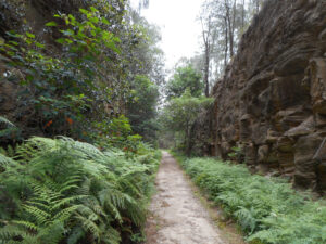
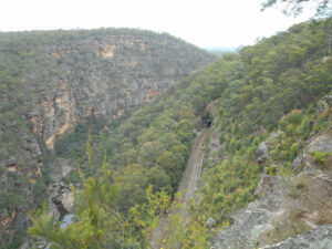
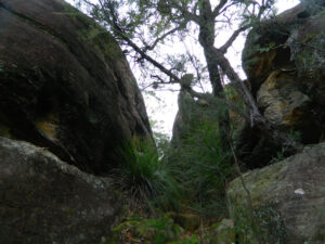

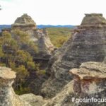
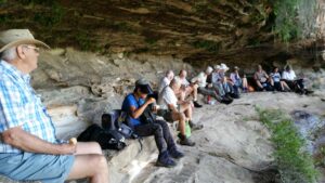
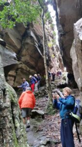
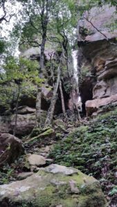
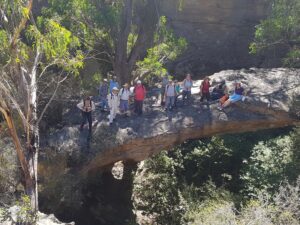
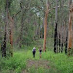
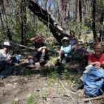
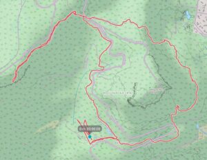
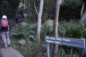 Once at the ring track we took the right fork to commence our anticlockwise circuit of the mountain. A lot of track improvements such as boardwalk installation and repair of steps has been completed allowing reopening of the ring track after past rock slides.
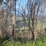
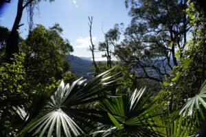 After another 400m the track touches the road again and we prepared to climb up the 100 odd steps to take us up to the next level section of the track through board walked rainforest then up another 296 steps where some nice views through the tree canopy to the north west were awaiting us, nearly an hour and a quarter into our walk.
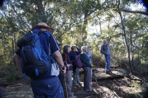 Then we followed the ring track downhill glimpsing the archery range located across from Byarong Park.