main

Tag Archives | bushwalking

Happy 90th Birthday Bushwalking NSW and Blue Gum Forest!

On 21 July it will be 90 years since the Federation of Bushwalking Clubs (now Bushwalking NSW) held its inaugural meeting. Soon after, on 2 September, we’ll see the 90th anniversary of the reservation of the iconic Blue Gum Forest, in the Grose Valley, following a campaign by bushwalkers.

The two events are not unrelated. The success of the collective action by the walkers had encouraged them to form the umbrella group which would assist Myles Dunphy and others in their campaigns to create national parks. Blue Gum Forest was the kernel of today’s Greater Blue Mountains World Heritage Area, and is the cradle of the modern conservation movement in NSW. You can read more about this in Andy Macqueen’s book “Back from the Brink: Blue Gum Forest and the Grose Wilderness”, which is available at Blue Mountains bookshops and here.

Celebratory campout

The saving of Blue Gum Forest will be celebrated on the weekend of 3-4 September 2022 by a campout in the Grose Valley, at The Meadow (near Acacia Flat). Attendance will be limited to members of clubs affiliated with Bushwalking NSW, and their families.

The agenda will include a ceremony at the forest on Saturday afternoon and a communal campfire in the evening. On Sunday morning some interpretive ambles will be on offer, the topics including birds, plants and geology.

The activity is being organised by volunteers, with the support of NPWS. Participants will have to make their own way in and out of the valley. Numbers will be capped at 80. Registration is essential and will be on a first-in-first-served basis. All participants:

  • Must be a member of a bushwalking club, or accompany such a person as a member of their family.
  • Will preferably be in a party organised under the rules of that club.
  • Must be experienced and self-reliant overnight walkers, or in the care of such a person. The access tracks are steep and involve 600 metres of vertical descent/ascent.
  • Are expected to car-pool, to limit traffic congestion at the track-heads.
  • Be packed up and making their way out of the valley by noon on Sunday.

Further details, including advice concerning track conditions (and closures if any) will be sent to registrants prior to the weekend.

For all enquiries please email Monica Nugent at monica.nugent@environment.nsw.gov.au

Every person, including family members, must be registered. REGISTER HERE.

Sydney Bush Walkers

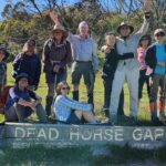
A Week of Walks, Kosciuszko National Park, Christmas/New Year 2021/22, Sydney Bush Walkers, Report by John Kennett, Photos by John Pozniak

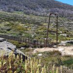
Between Christmas and New Year 2021/22 myself and thirty other members of Sydney Bush Walkers (SBW) travelled, walked and gathered on the trails and in the ski-lodges of beautiful Kosciuszko National Park.

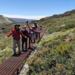
Every day we embarked on a different walk and were rewarded with the sight of brilliant blue skies, beautiful weather and voluminous wildflowers. Among the fantastic locations we visited were the Iconic Trails, Mt Twynham, Ramshead, Dead Horse Gap, Guthega, Mt Anton and Mt Tate.

To cap off a successful week our visit concluded with 2022 New Year’s Eve celebrations which were thoroughly enjoyed by all.

Our March Club: Sydney Bush Walkers

Our club of the month, Sydney Bush Walkers is one of Australia’s largest and oldest Bushwalking Clubs. SBW was founded in 1927 and has a membership of around 850.

The club offers challenging day and multi-day walks including extended 12 day (or more) trips.  Canyoning is a very popular club activity in the warmer months.

SBW volunteer trip leaders are experienced walkers who aim to maximise members enjoyment of the outdoors while also ensuring the safety of all walkers. While SBW leaders foster group co-operation participants are also expected to be self-sufficient to ensure that all members cope with walk conditions and challenges that arise.

While the Sydney Bushies provide a range of bush experiences, they also offer a great social network of like minded, outdoorsy types. A SBW membership provides a unique opportunity for bush lovers to develop skills, increase confidence and meet new like-minded friends!

The club holds monthly information nights for people who are considering joining (book here). For more information visit the SBW website or Facebook Page.


Watagan Wanderers Bushwalking Club

3 day hike, Barrington Tops NP, February 2022, Watagan Wanderers Bushwalking Club, Report & Images David Whyte

This hike was meant to be down Paterson’s Gorge but the predicted rain made that walk too dangerous. A nice alternative in the same area, and one we have done before, was to walk to Selby Alley hut and do a day walk from there around Edwards Swap.

The walk starts up with a steady climb up the Corker trail. The tall trees of the ancient beech forest add a lovely atmosphere to this walk and in summer offer a lot of shade. We have done this walk in winter where you are enclosed by mist. The lunch time break offers a magnificent view of Carey Peak in the distance which was our destination the next day

As we reached the top of the Corker track and it started to level out, we kept our eye out for a special dead tree marking the slightly hidden track to Selby Alley hut. It felt magical as we followed this secret path through dense forest, and then spotted the hut sitting just across from a beautiful stream that was softly meandering through sub tropical rainforest past the hut to nearby Basden Falls. We arrived at the hut mid afternoon giving us plenty of time to set up our tents and collect firewood. Despite being summer it was quite cool.

Leaving our tents up we set off the next day for a 20km walk around Edwards Swamp stopping at Careys Peak on the way. The clear morning offered stunning views over the valley below and the ridge that the Corker Trail follows. We spotted a few feral horses during the day and were saddened by how much broom there was growing; The Aeroplane hill track was quite dense in some areas. We cooked our dinner out in the open next to the fire and during the night the rain started to set in. We returned to our cars the next day via the corker trail in mist and listened to the sounds of lyre birds as we descended.

Our February Club: Watagan Wanderers Bushwalking Club

The Watagan Wanderers was established in the early 90s to meet the needs of people in The Central Coast, Lake Macquarie and Newcastle areas. It has an active program of providing day and multiday hikes over most of Australia and overseas. Though, since Covid the walks have become much more local. The club also has keen cycling, kayaking and abseiling groups. Our program can be found on our website.

Southern Highlands Bushwalkers

Mount Jellore, Nattai National Park, Southern Highlands Bushwalkers

A recent walk that Southern Highlands Bushwalkers managed to slot between various lockdowns was a hike up Mt Jellore in Nattai National Park. It had been couple of years since the Club had been on the Mount Jellore Walk as it has only recently re-opened after the bushfires.

There is a short walk to a rocky outcrop where you get the first view of the mountain, then a steep drop to a creek, followed by a steep walk up to the fire trail that leads to the base of Mt Jellore. From there it is a zig zag track up to the summit. There is now a lot of waist high regrowth. The trig at the top had survived the fires and from the peak you can see Sydney on a clear day. We took the alternative route back to the start which also involved a drop down to a creek followed by a climb back out.

Nattai NP offers beautiful wilderness and rugged walking experiences. The park is conveniently located close to several towns and features spectacular scenery and landscapes including sandstone cliffs, rainforests and woodlands. Walks in Nattai NP include Couridjah Corridor, Mount Jellore, Starlight’s or Nattai River.

Our January Club: Southern Highlands Bushwalkers

Southern Highlands Bushwalkers is an outdoor activities club which develops friendships through exploring natural wilderness and National Parks. The Club endeavours to plan activities to suit the needs of both individuals and families. Club activities range from short day walks to overnight backpacking hikes and car camp out weekends. However, other special activities may also be included in the Club’s programme.

The Club was formed in 1990 as the Highland Adventurers then underwent a name change to become the Southern Highlands Bushwalkers (Inc) in 1994. Since inception, membership has grown to about 60 and the members hail from as far afield as Palm Beach in the north to Goulburn in the south.

Southern Highlands Bushwalkers holds activities in the Mittagong, Bowral, Berrima area of the Southern Highlands of New South Wales. This area has a great diversity of flora and fauna and access to many national parks and forested areas. Most of the local area is undulating to steep, easy walks are very few and a reasonable standard of fitness is required.

The worn Sydney sandstone of the area offers some many interesting and beautiful windblown features with views from ridges into valleys, creeks and gullies. These offer glimpses of lush cool rain forest, eroded sculptured landscapes and stunning views down the valleys formed by the rivers such as the Nattai.

The club offers mostly day walks from moderately easy to strenuous with a range of overnight backpacks or car camps and the occasional trips to more distant destinations. Off track walking may be through thick and difficult vegetation which requires experience and good navigation skills. The Club also does coastal walks, mainly in the Illawarra as well as some on Sydney Harbour.


.

Great West Walk extended from Penrith to Katoomba

In great news for bushwalkers – the Great West Walk has been extended from Penrith to Katoomba!

The Walking Volunteers have loaded the walking route onto their Sydney Walking Tracks map and Great West Walk. If you have downloaded either of these maps onto your PS, smartphone or tablet they will be automatically updated to include an additional 150 kilometres of walking routes including the 87 kilometres of the main route.

The additional routes encompass a wide variety of walking conditions from easy station-to-station village walks to the more demanding Woodford-Hazelbrook section. The loops and links include diversions to historical sites like the 1892 Cutting, the Tunnel Creek Track and the iconic St Helena Track/Oaks Fire Trail Hike which is only suitable for experienced bushwalkers.

Cutting on the Top Road

… a funicular railway down to the 1913 rail route along Glenbrook Gorge

The St Helena Ridge Track runs through a narrow defiles …

Pool of Siloam is still …


As you would expect, the views in the Upper Blue Mountains are stunning but some of the lesser-known routes in the Lower Mountains and Mid-Mountains are just as astonishing. The main route runs past old inns, gatekeepers’ cottages, mountain cottages, intriguing ruins and a haunting cave site; along old railway cuttings and Cox’s original road; visits spectacular natural sites like Kings Cave, Leuralla Amphitheatre Sublime Point and Echo Point; passes man-made memorials at Macquarie’s Springwood Camp, Caleys Repulse, Honour Avenue, Coronation Park, and the haunting beauty of the Gully Walk.

Frederica Falls on Empire Pass

Western end of Mt Solitary from Prince Henry Cliff Walk below Sublime Point Reserve

… you look at it


The Walking Volunteers want to thank the Gundungurra ILUA Committee, Blue Mountains National Park and Blue Mountains City Council for allowing them to put this extension on their maps and providing vital information on temporary track closures between Gordon Falls and Echo Point, which are all marked on the maps with alternate routes. As these tracks are re-opened the Walking Volunteers will change their maps and these will be automatically updated.

Bankstown Bushwalking Club

FAULCONBRIDGE – VICTORY TRACK – NUMANTIA FALLS – MAGDALA CREEK – SPRINGWOOD, Saturday 23 October 2021, Report by Lynda Paju, Bankstown Bushwalking Club

A group of nine keen fully vaccinated walkers from Bankstown Bushwalkers gladly emerged from lockdown to enjoy the bush together again. Not being sure of fitness levels after such a long time confined to local areas, they returned to a favourite part of the amazing Blue Mountains. Spirits were high as walkers reconnected with old Club friends and organised a car shuttle at the start of the walk.

Before long they were enjoying each other’s company and a gentle descent along Sassafras creek. Despite fairly recent rains in Sydney there wasn’t a large volume of water in the waterfalls and the tracks were dry. They passed Clarinda Falls before taking a side trip to Numantia Falls for morning tea.

Numantia Falls


A leisurely lunch break at a lovely swimming hole near the Glenbrook Creek junction provided a chance for interesting conversation. A couple of party members even braved the icy creek waters for an extremely invigorating and refreshing swim! Of course, after heading down the creeks they had to head walk back up again. The walk up Magdala Creek was a fairly gentle ascent and the party paused at Martins Falls and Magdala Falls for short breaks on the way.

After a successful walk the party happily stopped for the traditional coffee and cake on the way home.

The general consensus was that the Club must go back on this walk again after more rain! After such a long period where people couldn’t get out and walk together the Club is now planning a lot of day walks, abseiling trips and other great activities. It is certainly going to be a busy summer for the Bankswalking Bushwalking Club!

Our December Club: Bankstown Bushwalking Club

Our club of the month Bankstown Bushwalking Club currently has just under 150 members. Bankstown Bushwalking Club prides itself on being friendly and inclusive. The Club offers walks at all grades from easy, social beginner walks through to multi-day, challenging and exploratory walks. The Club also offers abseiling training, canyoning, caving and multi-pitch abseiling trips.

Established in 1980, the Bankstown Bushwalking Club attracts members from all over Sydney. The Club’s program is published each quarter and short notice walks are advertised to members by email.

Bankstown Bushwalking Club has a Facebook Group and interested walkers are encouraged to join so they can get a feel for the Club. The Club also encourages interested people to do a couple of walks as a visitor to decide if they want to join or not. Please note that abseiling activities are restricted to fully paid Club members only.


Gardens of Stone Protected!

Australia’s longest conservation campaign delivers: Gardens of Stone Protected – New Gardens of Stone Conservation Area announced.

A quick background to the Gardens of Stone announcement:
  • The Australian conservation movement called for the protection of the Gardens of Stone region in 1932
  • In 1932, Colong Foundation for Wilderness founder, Myles Dunphy, included the Gardens of Stone in his ‘Greater Blue Mountains National Park Proposal’
  • In 1985, former Colong Foundation Director, Dr. Haydn Washington, published the Gardens of Stone Reserve Proposal
  • In 1994 the Liberal Environment Minister, Chris Hartcher, reserved the Gardens of Stone National Park (stage 1) after a strategic park proposal from the Colong Foundation for Wilderness while independents held balance of power in the NSW Legislative Assembly
  • In 2005, the Gardens of Stone Alliance formed, consisting of the Blue Mountains Conservation Society, Colong Foundation for Wilderness and the Lithgow Environment Group to coordinate a community campaign to protect the Gardens of Stone based on a state conservation area proposal by the Colong Foundation
  • In 2019, a comprehensive visitor management plan, Destination Pagoda, was released by the Gardens of Stone Alliance to showcase the economic benefits of the region
  • In 2021, Centennial Coal withdrew their proposal for the Angus Place Colliery after persistent campaigning from the Gardens of Stone Alliance

Keith Muir, former Colong Foundation for Wilderness Executive Director, has said “After what must be the longest protected area campaign in history, the Colong Foundation welcomes the new Gardens of Stone State Conservation Area of over 30,000 hectares which positions Lithgow as the gateway to the Gardens of Stone region.

“The new reserve ranks in the top 20 of most floristically diverse of all NSW State Forests, National Parks and Reserves, just behind Ku-ring-gai Chase National Park, but outranks them all on geodiversity.

“The funding provided will permit the establishment of a world-class tourism and conservation reserve protecting and presenting an astounding array of heritage values. It will improve the protection of internationally significant pagoda landscapes and remaining rare upland swamps. The area includes 84 threatened plant and animal species, such as the Giant Dragonfly, and 16 rare and threatened communities.

“The untapped tourism value of Lithgow’s Gardens of Stone backyard lies in the diversity and rarity of its scenery and native flora, and in its Aboriginal cultural heritage. These values will be protected and enjoyed by thousands of people.

“Lithgow will become the new Katoomba which was once a coal mining town, having successfully transitioned to a tourism based economy in the 1920s. It is testament to the persistent community campaign that this announcement has happened today.”

Blue Mountains Conservation Society

Various Bushwalks, Blue Mountains and surrounds, Words by Doug Nicholls, Blue Mountains Conservation Society.
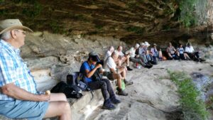
A typical lunch break, sitting under an overhang enjoying the view. This particular walk was on the Undercliff Track Wentworth Falls which is often done as a circuit with the Charles Darwin Walk and the Conservation Hut.
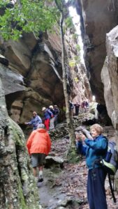
The Grand Canyon Circuit is a very popular family walk. If you only have time for one walk, this one is a good choice for a classic Blue Mountains experience.
Dargan Arch

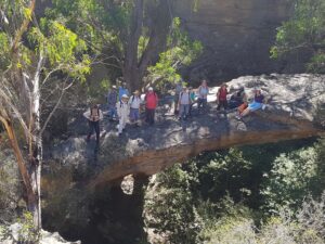
Dargan Arch in the upper Blue Mountains is an amazing natural sandstone arch in a gorge and an easy walk from carparking. To get to the bottom and under the Arch requires a little more effort but is well worth it.

Our November Club: Blue Mountains Conservation Society

The Blue Mountains Conservation Society (BMCS) has 330 bushwalking members who enjoy walking in amazing locations in the Blue Mountains and surroundings.

Blue Mountains Conservation Society has weekly bushwalks to suit a range of abilities held on Saturday, Monday, Tuesday and Thursday.  The Club’s walk details can be found on the BMCS website where the activity subsection will invite new walkers. BMCS also has a monthly Plant Study Group.

October 2021 was special as the Blue Mountains Conservation Society celebrated its 60th Birthday.

Comerang Mountain – Batemans Bay Bushwalkers

Comerang Mountain, Dampier State Forest, Sunday 21 February 2021, Walk Report by Rob Lees, Batemans Bay Bushwalkers

Seven hikers from Batemans Bay Bushwalkers set off on an exploratory walk to visit interesting geology seen on aerial photography in the creeks downslope from Comerang Mountain.

By definition an exploratory walk has not been reccied.  However, we do examine topographic maps beforehand to evaluate terrain and access roads and to estimate a walk time and route. This is very important so club members can decide if this walk is compatible with their abilities and expectations.

Notwithstanding our best efforts, the reality once on the walk can often be very different!

The first thing we discovered was that B-Travers road (a well-used mountain bike road before the 2020 bushfires) had not been cleared of fallen trees. As we had hoped to drive our vehicles along this road, our walk was increased by 2km just to get to the starting point.

I had also proposed to use a number of other logging roads to get best access to the creeks. However we also found out once on site that these roads had not been used in decades. This made navigation difficult due to the forest regrowth and fire damage.

However once we finally made it to the creeks it was worth the effort as everyone was pleased with the spectacular geology, waterfalls and ponds.  We noticed that the ancient volcanic rocks were highly fractured and very resistant to erosion which created the spectacular scenery. To our delight, in one pool we saw an eel and many small fish.

As walk leader I quickly realised we were not going to be able to visit all the outcrops that I had hoped to see and so we headed back upslope to Comerang Mountain. We knew the climb was going to be tough given the high humidity and temperatures that exceeded all projections. After the ascent, and with only 3kms remaining down a flat trail, we seven weary hikers were happy but also very glad that we would soon see our cars!

I will plan another exploratory walk in the winter that will go straight to the larger outcrops via a different route. I am hopeful that the scenery will be even more spectacular than what we experienced on the Comerang Mountain walk today.

Our Club of the Month: Batemans Bay Bushwalkers

Our club of the month Batemans Bay Bushwalkers are a crew of around 200 members, who have the shared goal of finding, exploring and enjoying the natural secrets of the national parks and forests of the NSW South Coast. First formed in 1985, Batemans Bay Bushwalkers are not-for-profit and run by volunteers.

Batemans Bay Bushwalkers publishes 4 Walks Programs per year, with 2 walks a week of varying grades. Visitors are covered by insurance for 3 walks each financial year to allow them to come and try Club walks. Walks are led by volunteer Walk Leaders, who carry a GPS, topographic map, and when appropriate, a safety beacon.  Walk are graded according to difficulty so members can choose walks to suit their level of ability.

Batemans Bay Bushwalkers club members also get together for a variety of social activities and camps.


Blue Mountains Kanangra-Boyd National Parks – Planning Workshop Outcomes

NSW NATIONAL PARKS & WILDLIFE SERVICE

Summary of workshop outcomes June 2021,

Blue Mountains National Park & Kanangra-Boyd National Park Draft Plan of Management

Background

The NSW National Parks and Wildlife Service (NPWS) is developing a new plan of management for Blue Mountains National Park and Kanangra-Boyd National Park to set long term directions for the management of these national parks.

NPWS facilitated 4 workshops between 4 and 6 June 2021 to elicit stakeholder views and feedback on a range of matters, including:
• management of adventure recreation activities, including abseiling, canyoning, rock
climbing and slacklining
• management of recreation in wilderness areas
• management of key visitor sites.

Feedback on each of these discussion themes and other issues is summarised below. In this document, NPWS has endeavoured to reflect the feedback provided by workshop participants as accurately as possible. The points listed below do not necessarily reflect the views of all workshop participants.
2
Adventure recreation
General
• NPWS should use existing user groups to reach out and educate new users – e.g.
climbing gyms, outdoor clubs, university clubs, education groups.
• Visitors to the parks value the experience of being in the park and are concerned about
their own safety.
• Environmental sustainability and visitor safety are often compromised when large
groups are involved in adventure recreational activities.
• The focus of management should be on proper risk management and auditing, rather
than exclusively on limiting group size.
• The Australian Adventure Activity Standards (AASs) represent significant work and
thought by industry professionals. As such, NPWS group size limits should align with
these as much possible. Activity-specific Good Practice Guides (GPG) provide
recommendations about group sizes.
• One organisation represented at the workshop highlighted that compulsory adoption of
AAS standards and the GPG was not supported.
• Clubs are generally well managed and concerned about risk. They rely on selfregulation because they are not sufficiently resourced to adopt additional responsibilities
for the management of their members.
• A participant described the group size limits set by NPWS as generous.
• One business highlighted that they may use smaller groups than allowed.
• Improved communication methods are required to disseminate information about the
rules for each activity (e.g. a broader range of social media platforms, different
languages etc.).
Abseiling
• Maintaining a group size limit of 8 participants (and one guide) was appropriate.
• For multi-pitch abseiling, a reduced group size limit of 4 participants (and one guide)
was more appropriate.
• Larger group sizes were generally not appropriate but could be feasible at specific sites.
Canyoning
• The ‘canyoning community’ is working on a best practice document that addresses
environmental risk, cultural risk, and safety risks. This document can be provided to
NPWS.
• Maintaining group size limits was necessary to maintain individual and group safety and
to minimise any environmental impacts.
• Social media is motivating participants with insufficient skills to undertake the activity.
There may be opportunities to utilise social media to promote safety messages.
• Some people are attempting canyoning with limited experience and without the support
of a club.
• Group size limits should be conservative and appropriate for the canyon. A group size
of 10-12 was considered too high.
3
• Use of a booking system was supported at popular sites.
• Group size limits should apply to both commercial and non-commercial groups. Guides
help to reduce impacts and therefore should be allowed as an addition to the group size
limit.
• There should be a cap on total group numbers (commercial and non-commercial) per
canyon, per day, to manage current and future use.
• NPWS should consider adopting management strategies like those used by the US
National Parks Service.
• Education providers could benefit if they were licensed as commercial tour operators.
This would enable them to access improved operating arrangements including use of
the DigiRez booking system.
Rock climbing
• Top-rope climbing should have the same group size limit as applies to abseiling.
• A group size limit should be 4 or 5 participants per roped party.
• Bolting in the parks is an ongoing issue of concern. It was suggested that an updated
bolting policy and/or further discussion with NPWS is required. It was recommended that
the QLD Government’s approach to management should be considered.
• There have been some changes in group behaviours in recent years (for example,
visitors playing music when out in the parks).
• Group size limits should apply to both commercial and non-commercial groups. As
guides help to reduce impacts, they should be allowed as an addition to the group size
limit.
• The current approach to managing bolting/anchor points is not working. Further
engagement is needed to increase self-regulation, minimise impacts and maximise
safety.
• It was acknowledged that risk management was a complex issue and beyond the scope
of the plan of management to resolve.
• Australian Climbing Association has a climbing database (The Crag) that could be
utilised to improve communication with climbers about specific sites.
• Rock climbers should not be a source of revenue.
• Any plans to apply zoning for different types of climbing will require further consultation
with climbers.
• Education is needed for rock climbers on how to manage their waste.
Slacklining
• Slacklining was defined as the temporary use of trees in disturbed areas such as visitor
precincts (camping areas or day use areas where there isn’t high visitor traffic)
• Highlining was defined as the temporary use of cliff features and existing anchors/bolts
(rock climbing) for traversing on a safety line across airspace.
• There is interest in both recreational-based slacklining and event-based slacklining.
• The Australian Slacklining Association has established a code of conduct, fixed anchors
guidelines and guidelines regarding airspace safety. There is also an Adventure Activity
Standard in place.
4
• Slacklining is an emerging, legitimate adventure activity both in Australia and
internationally and it is therefore appropriate that NPWS makes provision for the activity
in the plan of management.
• Issues include impact on ecologically sensitive sites, the potential for noise pollution
(from webbing), air space /aviation safety, impact on scenic values and damage to
trees.
• Limits should apply on the duration of slacklines (e.g. 1 day).
• Variations of the activity include water-lining, yoga-lining, and trick-lining. Parks are not
a major focus for these activities.
• The strategies used by NPWS to manage other adventure recreational activities should
be sufficient to provide for the safe and sustainable authorisation of slacklining.
Recreation in wilderness
General
• A group size limit of 8 should be retained.
• Guides actively manage group behaviour. For this reason, the allowance of 2 guides for
commercial tour operators should be extended to educational groups.
• There is a need for active management in response to degradation around Burra Korain,
Dex Creek and Mobbs Swamp camping areas.
• Divergent views were expressed about the introduction of toilets and other infrastructure
to manage impacts. Most participants were supportive of the establishment of minimalist
and carefully designed infrastructure (including toilets), provided this was part of a more
holistic strategy which sought to avoid infrastructure development wherever possible.
Several participants highlighted the need for sound evidence before infrastructure
development in Wilderness areas is considered.
• The requirement to book all camping areas limits the freedom of individual choice and
requires all camping to become a pre-planned activity (rather than a spontaneous one).
• Designation of campsites and access via a booking system may be necessary.
However, the designation of campsites should not restrict options for walkers that still
wanted to enjoy dispersed bush camping.
• Information and education should be retained as the primary strategies for preserving
wilderness values.
• Information for walkers about wilderness boundaries should be improved as many
visitors don’t know when they were entering a wilderness area.
• The risk of exceeding the carrying capacity of wilderness areas was a major theme of
discussion. It was highlighted that social media and the promotion of wilderness
experiences (especially during peak visitation periods) presented a risk to wilderness
values.
• Marketing should avoid promotion of wilderness experiences during periods of peak
visitation.
• The parks are significant for the preservation of wilderness values, and the unique
experiences that these wilderness areas provide.
• The plan of management should include strategies to retain opportunities for people to
enjoy true wilderness experiences in the long-term and that these strategies should
seek to prevent the application of more interventionist strategies (e.g. toilets) in the long
term.
5
• More active wilderness preservation strategies (e.g. toilets) would be more appropriate
in areas that were of lower wilderness quality such as the Grose Valley.
• There is a concern that people may become lost following incorrect trails that have
developed through use. Remedial work, consistent with the retention of wilderness
values (including vegetation management and track works) was supported.
Visitor facilities
General
• The current event application process is overly onerous for small smaller organisations
conducting small scale events.
• The factors involved in providing a sound rationale for visitor facility investment (and
disinvestment) should include visitor demographics and demand.
• There are opportunities to work cooperatively with Blue Mountains City Council and
private sector partners, across tenure and on private property to address visitor facility
needs.
• Facilities (including campsites) need to cater for a broad range of abilities and
experiences. There should be areas designated for caravans, walkers, and car-based
visitors.
• Visitors are also looking for shorter walks and picnics in natural settings.
• Strategies to address carrying capacity and spread visitation onto other areas (and to
undertake other activities) need to be developed.
• Degradation of some camping areas was noted. Some should remain undeveloped and
unregulated while it may be appropriate at others to manage impacts and level of use
through improved facilities and bookings.
• The scale-up and scale-down of campsites were raised as an option to facilitate
recovery of impacted sites.
• Consider a classification system for campsites to ensure that visitors have clear
expectations about levels of service.
• Some climbers would appreciate having access to climber-only camping sites.
• Some campgrounds are currently used by caravaners and camper-trailer campers (e.g.
Dunphy’s, Green Gully & Boyd River).
• The facilities required for caravan and camper-trailer camping (electricity supply, areas
for generators, waste dump points etc.) were discussed. Concerns were raised about
the impact of these facilities on the park experience.
• Participants opposed caravans and camper-trailers being used in the park as there are
sufficient alternatives for these styles of camping outside the park.
• The use of camping areas by commercial operators needs to be appropriately managed
to ensure access by other visitors is not compromised.
• Permanent camping should not be allowed.
• Visitor safety, access and environmental protection should be considered during
detailed design for visitor sites.
• Some improvements are required to facilities that are causing adverse impacts on
environmental values (sedimentation from trails, roads and carparks, toilets etc.).
• Improvements are required to soft infrastructure (online information, maps etc.).
6
• The role of site design in managing visitor expectations and in offering a range of high
quality experiences was a focus of discussion.
Access to visitor sites
• Private tourism developments within the parks including luxury lodges and glamping
within existing campsites was opposed.
• There are not enough places to provide accessible adventure activities for people living
with disability. Modified gates to provide access could be utilised. An accessible ‘great
walk’ could be considered.
• Arrangements for access to the park through private property (and access to private
inholdings) requires clarification in the plan. Private landholders often do not allow
access across their land to the parks because they are concerned about public liability.
• Providing access could create camping opportunities at sites including Kedumba Valley
(larger groups), Pack Saddles (small groups) and Canyon Colliery.
• Opportunities for camping at Green Gully should be considered during development of
the precinct plan for that site.
• There is demand for campsites that cater for larger groups. This may take pressure off
smaller sites.
• Access at Dunphy’s requires resolution.
• Yerranderie and Wolongambe have opportunities for camping but access issues would
require resolution. Ingar also has great opportunities for camping however restrictions
with access would require resolution.
• Cross-tenure arrangements need to be considered at Ingar to allow access to NPWS
assets.
• Perry’s Lookdown does not offer a quality camping experience. This requires resolution.
• There was a recommendation that the Blue Labyrinth should be managed as a remote
natural area. The last plan of management recommended sealing the road to Nepean
Lookout. This is not appropriate for tradition and history reasons.
Online booking
• The pros and cons of bookings systems were discussed. There are challenges
associated with booking groups however a booking system can help to change
behaviour, cap numbers, and generate improved experiences.
• Bookings need to be easy, flexible for groups, allow for spontaneity, and consider safety
and park management needs. The system needs regular review to ensure functionality
and effectiveness.
• Maintaining records of trip intentions is another way of monitoring visitor numbers.
• Sydney people are getting used to online booking for campsites. This system could be
expanded to encompass booking for day trip experiences.
• There is support for bookings and revenue collection where revenue can be reinvested
into the park.
• There have been instances where people have booked campsites and have then not
utilised their booking. This is a problem with the online booking system because it has
potential to restrict access for campers and could encourage larger groups and illegal
party’s that could impact on other campers.
• Booking platform (Digirez) needs to recognise a diversity of sites to match the type of
experiences and people that are booking. Currently it is too restrictive.
7
• To plan their camping trip, people need to access information about campsite sizes and
numbers group sizes before they access the Digirez platform.
Potential improvements to visitor sites
• Schools use the parks for multi day walks (with self-sufficient camping) and school
camps. School camps require larger campgrounds, toilets, and vehicle access. Sites like
Mount Wilson and Newnes are important. There may also be opportunities at Euroka
and Green Gully.
• Green Gully Cabins are currently under-utilised, and consideration should be given to
better manage the site and its future use.
• It was suggested that camp hosts could be better utilised.
• Hanging Rock needs implementation of a site management plan.
• NPWS maintenance and upgrades of existing tracks (including Grand Canyon) were
commended. Providing good quality tracks in popular areas attracts novice bush
walkers and leaves more difficult walks for those with more experience.
• Govetts Leap upgrades were discussed. It was acknowledged that, while improvements
seemed logical, residents may have strong views about things that affect them directly.
• The following areas within and outside the parks could be considered for improved
access and facilities: Narrow Neck, Wolgan, Victoria Falls Road, Evans Lookout,
Kedumba, Greens Gully, Mt Banks, Wolongambe, Bells Line Road, Acacia Flat
campground, Wentworth Falls, Conservation hut, Copeland Pass and Yerranderie.
• Upgrade is required for the Copeland Pass Track.
• The K2K walk experience should be supported.
• Upgrades are required at trail heads to provide toilet facilities and improved information.
• Facilities at popular climbing areas should be upgraded to include toilet facilities.
• A walking loop from Turras Ladders east to Kedumba River, K2K to Solitary was
suggested. Catchment restrictions were acknowledged.
Other issues
Information
• Online communication about park access requires improvement. Alerts are not updated
often enough.
• Visitors need better information from utilities when they close tracks to undertake work.
It is hard to determine if whole or part of a track is closed and whether you can walk
around the closure.
• Strategies are required to communicate the boundaries between the parks and council
land.
• Bushwalking NSW are seeking more engagement with NPWS on matters of mutual
interest.
• Recreational organisations provide opportunities for improved communication about
park management (e.g. Bushwalking NSW newsletter).
• Communication to visitors could be improved through the application of consistent
signage across tenures.
8
Visitor management
• Increased visitation (and the resultant pressures on the park and the visitor experience)
is an issue that needs to be addressed at a strategic infrastructure planning level, and
through marketing and information.
• The lack of park entry fees was questioned, with some support for fees in areas with
facilities. The application of fees within wilderness areas was not supported.
• Increased visitation is restricting carparks for some residents. It was suggested that
NPWS should cooperate more with local government to improve carparking adjacent to
the parks.
• Strategies for the management of visitors and tourists should be consistent.
Plan of management
• The plan should integrate with other relevant planning documents including special
areas plans for catchments, world heritage plans, indigenous land use agreements,
heritage plans, tourism plans, plans for adjacent parks and precinct plans.
• Some people would like to see what actions have been completed in the current plan of
management.
• NPWS needs to allow adequate time for groups/stakeholder to consider information
when consulting.
• Climate change impacts on park values, use and management (including park closures,
fire, water, pest management and changing visitor use patterns) need to be addressed
in the plan.
• Plan needs to provide scope to respond to unforeseen or emerging issues (e.g.
birdwatchers following honeyeater migration, changed flight paths with the new airport
and dam development proposals).
• Pest plant and animal management should be a focus for the plan of management.
• The plan of management should seek to improve the interpretation of Aboriginal cultural
heritage and non-Aboriginal cultural heritage within the parks.
• The plan of management should provide scope for the application of Aboriginal names
in the parks.
Fire management
• Increased burning in wilderness areas should not be to be used to achieve prescribed
burns targets.
• Fire management should be ecologically based– with specific assets targeted for fire
protection.
World heritage
• A consistent approach to management and improved communication about the World
Heritage Area is required.
• The World Heritage Working Group should engage more broadly with the community.
Drones
• Drones are now common within the escarpment including at lookouts.
9
• Concerns were raised about the safety of drones and disturbance to visitors.
• Support was expressed to exclude drones from the parks